
Fernandina Beach in Nassau County, Florida — The American South (South Atlantic)
Peck High School
Photographed by Tim Fillmon, April 9, 2016
1. Peck High School Marker-Side 1
(Side 1)
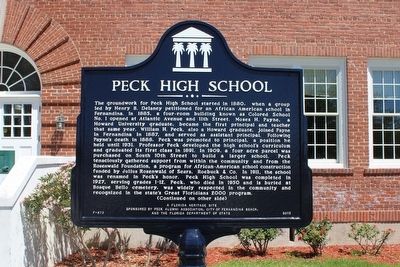
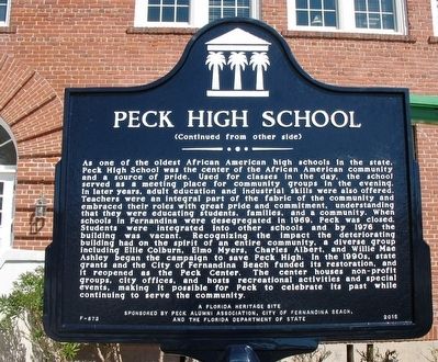
The groundwork for Peck High School started in 1880, when a group led by Henry B. Delaney petitioned for an African American school in Fernandina. In 1885, a four-room building known as Colored School No. 1 opened at Atlantic Avenue and 11th Street. Moses H. Payne, a Howard University graduate, became the first principal and teacher that same year. William H. Peck, also a Howard graduate, joined Payne in Fernandina in 1887, and served as assistant principal. Following Payne’s death in 1888, Peck was promoted to principal, a position he held until 1931. Professor Peck developed the high school’s curriculum and graduated its first class in 1891. In 1909, a four acre parcel was purchased on South 10th Street to build a larger school. Peck tenaciously gathered support from within the community and from the Rosenwald Foundation, a program for African-American school construction funded by Julius Rosenwald of Sears, Roebuck & Co. In 1911, the school was renamed in Peck’s honor. Peck High School was completed in 1927, serving grades 1-12. Peck, who died in 1950 and is buried at Bosque Bello cemetery, was widely respected
this page online
(Side 2)
Photographed by Tim Fillmon, February 26, 2016
2. Peck High School Marker-Side 2
Erected 2015 by Peck Alumni Association, City of Fernandina Beach, and the Florida Department of State. (Marker Number F-873.)
Topics and series. This historical marker is listed in these topic lists: African Americans • Civil Rights • Education. In addition, it is included in the Historically Black Colleges and Universities, and the Rosenwald Schools series lists.
Location. 30° 39.788′ N, 81° 27.469′ W. Marker is in Fernandina Beach, Florida, in Nassau County. It is at the intersection of South 10th Street and Fir Street, on the right when traveling north on South 10th Street. Building now houses the Peck Center. Touch for map. Marker is at or near this postal address: 516 S 10th St, Fernandina Beach FL 32034, United States of America. Touch for directions.

Regionally, this marker is in Florida’s First Coast,
Photographed by Tim Fillmon, April 9, 2016
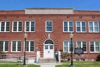
3. Peck High School Marker and school
Other nearby markers. At least 8 other markers are within walking distance of this marker: Fairbanks Home (approx. 0.3 miles away); Macedonia African Methodist Episcopal Church of Fernandina (approx. 0.3 miles away); Trinity United Methodist Church (approx. 0.4 miles away); First Missionary Baptist Church of Fernandina (approx. half a mile away); The Old Nassau County Jail (approx. half a mile away); Nassau County American Revolutionary War Memorial (approx. half a mile away); New Zion Baptist Church (approx. half a mile away); St. Peter's Church (approx. half a mile away). Touch for a list and map of all markers in Fernandina Beach.
Photographed by Tim Fillmon, April 9, 2016
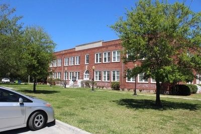
4. Peck High School
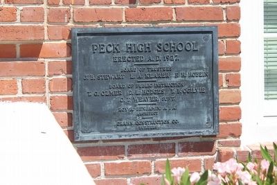
Photographed by Tim Fillmon, April 9, 2016
5. Plaque at front entrance
Credits. This page was last revised on February 10, 2018. It was originally submitted on April 12, 2016, by Tim Fillmon of Webster, Florida. This page has been viewed 1,592 times since then and 96 times this year. Photos: 1, 2, 3, 4, 5. submitted on April 12, 2016, by Tim Fillmon of Webster, Florida. • Bernard Fisher was the editor who published this page.
