Upper Sandusky in Wyandot County, Ohio — The American Midwest (Great Lakes)
Battle Island
Ohio Revolutionary Memorial Trail
»»««
About one mile east, on
June 7-8, 1872, Crawford's
expedition was annihilated
by the Indians and its
commander captured.
Also the site of a famous
Indian Gantlet Ground.
Erected 1930 by Ohio Revolutionary Memorial Commission. (Marker Number C.)
Topics and series. This historical marker is listed in these topic lists: Native Americans • War, US Revolutionary. In addition, it is included in the Ohio Revolutionary Memorial Commission series list. A significant historical year for this entry is 1872.
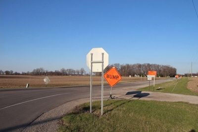
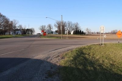
Location. Marker is missing. It was located near 40° 51.697′ N, 83° 16.717′ W. Marker was in Upper Sandusky, Ohio, in Wyandot County. Marker was at the intersection of Ohio Route 53 and Ohio Route 67, on the right when traveling north on State Route 53. This missing marker was located along the Ohio Revolutionary Memorial Trail that runs from Upper Sandusky to Port Clinton and follows along State Route 53. Touch for map. Marker was in this post office area: Upper Sandusky OH 43351, United States of America. Touch for directions.
Other nearby markers. At least 8 other markers are within 2 miles of this location, measured as the crow flies. A different marker also named Battle Island (approx. 0.6 miles away); Upper Sandusky (approx. 1.2 miles away); a different marker also named Upper Sandusky (approx. 1.4 miles away); "Enjoy The Day” Bench (approx. 1˝ miles away); Wyandot County's WWI Veterans Memorial Bench (approx. 1.6 miles away); Wyandot County's WWII Veterans Memorial Bench (approx. 1.6 miles away); Wyandot County's Cold War Veterans Memorial Bench (approx. 1.6 miles away); PFC William Naus Memorial (approx. 1.6 miles away). Touch for a list and map of all markers in Upper Sandusky.
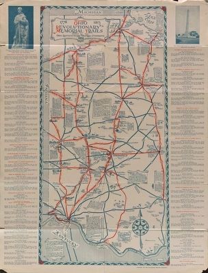
More about this marker. This historical marker is part of the Ohio Revolutionary Memorial Trail series (type C) which was put in place in 1930 to celebrate the 150th anniversary of the Ohio's Revolutionary War era Battle of Piqua, by the Ohio Revolutionary Memorial Commission.
In order to accomplish this, in 1929 the state of Ohio created the Ohio Revolutionary Memorial Commission, and then in 1930 this commission created 22 military trails, throughout western Ohio, between Cincinnati, Ohio on the state's southern border and Toledo, Ohio on the state's northern border. Each of these military trails represented the routes, or
trails, used by military leaders during either the Revolutionary War, the Indian Wars of 1790 to 1795, or the War of 1812. Each of these military routes connected various related historical sites, that were marked with Ohio Revolutionary Memorial Commission (type C) markers, along each of the military trails.
The routes of these military trails were in turn marked by type A and type B Ohio Revolutionary Memorial Commission markers that served as directional (type B) and distance (type A) markers.
Originally, back in 1930, there were erected 70 some of these Ohio Revolutionary Memorial Commission, type C, markers. To date, there are only 20 some of them that have been located and posted on the Historical Marker database. A number of them are presently missing, including this particular marker.
Related markers. Click here for a list of markers that are related to this marker. To better understand the relationship, study each marker in the order shown.
Also see . . . Ohio Revolutionary Memorial Trail System. A description of the Revolutionary Memorial Trail System developed by the state of Ohio in 1929 - 1930. (Submitted on April 17, 2016, by Dale K. Benington of Toledo, Ohio.)
Photographed By Dale K. Benington, April 16, 2016
3. Batte Island Marker
View of the missing maker site, looking north along State Route 53, which was part of the Ohio Revolutionary Memorial Trail System. The marker would have been just to the left of the nearby, backward facing stop sign, facing north and south along State Route 53.
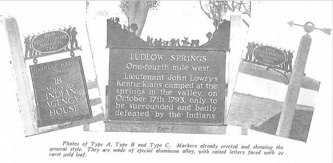
Photographed By Ohio Revolutionary Memorial Commission
5. Ohio Revolutionary Memorial Commission Marker Types
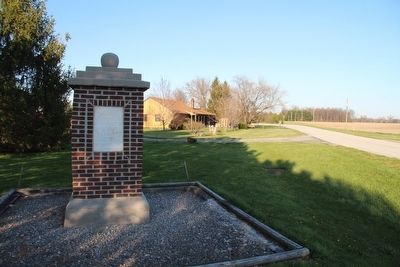
View of the three types of markers used by the Ohio Revolutionary Memorial Commission. The marker on the left is a type A marker, the marker in the middle is a type C (just like our missing marker), and the marker on the right is a type B.
Credits. This page was last revised on July 25, 2022. It was originally submitted on April 13, 2016, by Dale K. Benington of Toledo, Ohio. This page has been viewed 990 times since then and 55 times this year. Photos: 1, 2, 3, 4. submitted on April 17, 2016, by Dale K. Benington of Toledo, Ohio. 5, 6. submitted on April 20, 2016, by Dale K. Benington of Toledo, Ohio.

