Suchitoto, Cuscatlán, El Salvador — Central America (West Coast)
Structure 4E1 or Cabildo
Estructura 4E1 o El Cabildo
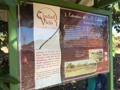
Ubicado al Noroeste de la Plaza Mayor, la estructura conocida como 4E1 ha sido identificada como el edificio donde antiguamente funcionaba el Cabildo de la antigua Villa de San Salvador.
Pie de dibujos: Proceso de restauración y consolidación efectuado en la escalinata que sirvió de acceso principal al Cabildo.
Fachada principal del Cabildo.
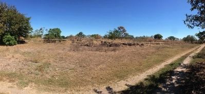
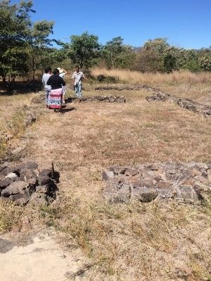
It was possible to identify it because of its location, methods of construction, floor plan and cultural materials that were found during excavations. This building was the place where civil and administrative power was practiced by the Spanish. The structure is built on and in the middle of andesite rock that was also used for its construction. Building materials were: floor and roof tiles, bricks, cobble stone and dirt. This structure has a rectangular shape with dimensions of 6.5 m. North-South, 28.5 east-West and 1.3 m. in height.
Located northwest of the Plaza Mayor, the structure designated as 4E1 was the Town Hall of the city of San Salvador.
Captions: The restoration and consolidation process completed on the stairsteps that were the main entrance of the Town Hall.
The main facade of the Town Hall. (Marker Number 1.)
Topics. This historical marker is listed in these topic lists: Colonial Era • Government & Politics • Man-Made Features.
Location. 13° 51.605′ N, 89° 1.973′ W. Marker is in Suchitoto, Cuscatlán. The marker is at the Ciudad Vieja Archaeological Site near Suchitoto, El Salvador. Touch for map. Marker is in this post office area: Suchitoto, Cuscatlán 01400, El Salvador. Touch for directions.
Other nearby markers. At least 8 other markers are within 10 kilometers of this marker, measured as the crow flies. Structure 4D1 (within shouting distance of this marker); Church Platform (about 90 meters away, measured in a direct line); Ciudad Vieja Archaeological Site (about 90 meters away); Structure 3D2 (about
120 meters away); Streets of Ciudad Vieja (about 150 meters away); Structure 1D1 or Southern Surveillance Point (approx. 0.3 kilometers away); Historia de / History of Suchitoto (approx. 8.6 kilometers away); The Church of Santa Lucía (approx. 8.6 kilometers away). Touch for a list and map of all markers in Suchitoto.
Credits. This page was last revised on July 28, 2019. It was originally submitted on April 16, 2016, by J. Makali Bruton of Accra, Ghana. This page has been viewed 281 times since then and 9 times this year. Photos: 1, 2, 3. submitted on April 16, 2016, by J. Makali Bruton of Accra, Ghana.


