Boston in Erie County, New York — The American Northeast (Mid-Atlantic)
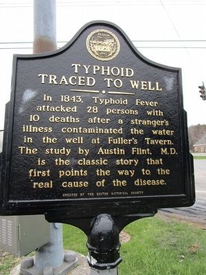
Typhoid Traced to Well
Traced to Well
——•——
In 1843, Typhoid Fever
attacked 28 persons with
10 deaths after a stranger's
illness contaminated the water
in the well at Fuller's Tavern.
The study by Austin Flint, M.D.
is the classic story that
first points the way to the
real cause of the disease.
Erected by Friends of the Boston Historical Society.
Topics. This historical marker is listed in this topic list: Science & Medicine. A significant historical year for this entry is 1843.
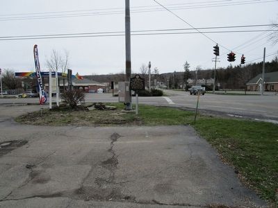
Location. 42° 41.141′ N, 78° 46.614′ W. Marker is in Boston, New York, in Erie County. Marker is at the intersection of Boston State Road (New York State Route 391) and Zimmerman Road (County Route 437), on the right when traveling east on Boston State Road. State routes 391 and 277 terminate at the intersection. Touch for map. Marker is at or near this postal address: 7186 Boston State Road, Hamburg NY 14075, United States of America. Touch for directions.
Other nearby markers. At least 8 other markers are within 4 miles of this marker, measured as the crow flies. First Fire Company (about 500 feet away, measured in a direct line); Site of the John Love Murder (approx. ¾ mile away); Home of Tallcut Patchin (approx. 1.8 miles away); West Boston (approx. 2.3 miles away); Boston's First Settler (approx. 2.9 miles away); Erie County (approx. 3 miles away); Anna Mae Bacon Bird Sanctuary (approx. 3.3 miles away); The Village of Hamburg (approx. 3.4 miles away). Touch for a list and map of all markers in Boston.
Credits. This page was last revised on June 16, 2016. It was originally submitted on April 19, 2016, by Anton Schwarzmueller of Wilson, New York. This page has been viewed 639 times since then and 47 times this year. Photos: 1, 2. submitted on April 19, 2016, by Anton Schwarzmueller of Wilson, New York.

