Fort Bliss in El Paso County, Texas — The American South (West South Central)
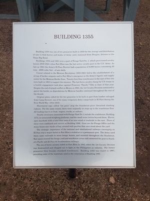
Building 1355
Buildings 1355 and 1361 were a part of Forage Yard No. 1, which provisioned cavalry horses 1919-1943, when Fort Bliss was the last active cavalry post in the U.S. Army. As late as 1941 the Army's El Paso District had a population of 8,000 horses consuming 40 tons - 2500 cubic feet - of oats daily.
Unrest related to the Mexican Revolution (1910 - 1921) led to the establishment of a string of border outposts and to Fort Bliss's emergence as the Army's logistic and supply center for the Mexican Border Zone. Twenty-four Zone warehouses to the east of this site were built in 1921 to support this mission. The last horse cavalry charge by U.S. Troops in a hostile engagement took place against Francisco "Pancho" Villa in June of that year. Despite the end of armed conflict in Mexico in 1921, the 1st Cavalry Division continued to patrol the border, as depredations by Mexican bandits continued throughout the rest of the decade.
Original plans called for the two granaries to be built in part from lumber salvaged from Camp Stewart, one of the many temporary Army camps built in El Paso during the First World War (1914-1918).
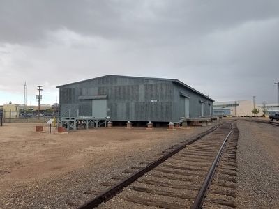
Sheetmetal caps called "rat pans" atop the foundation piers thwarted climbing rodents. For the same reason, there were originally no steps up the the warehouse floor. All loading was to or from wagons, trucks, or railcars.
Nearby structures associated with Forage Yard No. 1 include the scalehouse, Building 1372, its associated weighing platforms, and the small stone latrine beyond them. Eleven open haysheds with a total floor area of an acre stood at trackside to the east. Three of these were combined and survive as Building 1208. Gone are the Forage Office and the many house-sized stacks of hay covered with paulins that once stood about the yard.
The strategic importance of the national and international railways converging on El Paso was a major factor in Fort Bliss's evolution to a permanent post. The Army used these same railroads to move troops, horses, and material throughout the Southwest. Rail spurs crossed the forage yard and warehouse areas and connected the post to Southern Pacific and El Paso & Southwestern railways.
The era of the horse cavalry ended at Fort Bliss in 1943, when the 1st Cavalry Division was dismounted and shipped out to fight in the Philippines as infantry. The former granaries then became standard warehouses. Building 1355 was razed in 1997, providing some of the materials used in the renovation of Building 1361.
Topics. This historical marker is listed in this topic list: Wars, Non-US.
Location. 31° 48.864′ N, 106° 25.816′ W. Marker is in Fort Bliss, Texas, in El Paso County. Marker is on Marshall Road, on the right when traveling north. Touch for map. Marker is in this post office area: El Paso TX 79906, United States of America. Touch for directions.
Other nearby markers. At least 8 other markers are within walking distance of this marker. Second Expansion Period Group (within shouting distance of this marker); Building 1372 (within shouting distance of this marker); First Expansion Period (approx. 0.4 miles away); Initial Construction Period (approx. half a mile away); Historical Building 241 - The Guardhouse, 1893 (approx. half a mile away); V2 Rocket (approx. half a mile away); Quarters 236 Sheridan (approx. half a mile away); AH-1F COBRA Attack Helicopter (approx. half a mile away). Touch for a list and map of all markers in Fort Bliss.
Credits. This page was last revised on June 16, 2016. It was originally submitted on April 27, 2016, by Kevin W. of Stafford, Virginia. This page has been viewed 336 times since then and 12 times this year. Photos: 1, 2. submitted on April 27, 2016, by Kevin W. of Stafford, Virginia.

