Near Scotland in St. Mary's County, Maryland — The American Northeast (Mid-Atlantic)
Point Lookout Confederate Cemetery
Photographed by Tom Fuchs, March 31, 2007
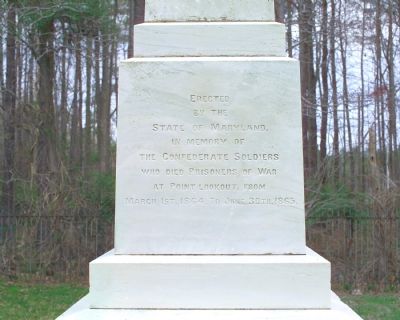
1. Front Inscription on State Monument
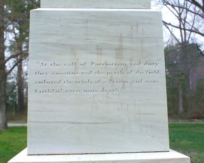
(north face) “At the call of Patriotism and duty they encountered the perils of the field, endured the trials of a Prison, and were faithful, even until death.”
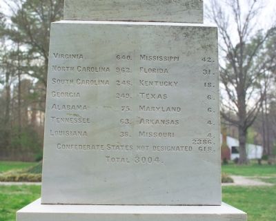
(east face) Virginia 640 • North Carolina 962 • South Carolina 248 • Georgia 249 • Alabama 75 • Tennessee 63 • Louisiana 38 • Mississippi 42 • Florida 31 • Kentucky 18 • Texas 6 • Maryland 6 • Arkansas 4 • Missouri 4 • [Subtotal] 2386 • Confederate States not designated 618 • Total 3004.
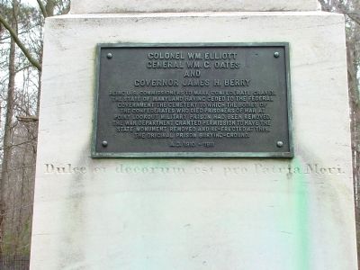
(south face) Dulce et decorum est pro Patria Mori. (A line of verse in Latin, by the Roman lyrical poet Horace, which means “It is right and proper to die for one’s country.”)
(brass tablet added to the south face) Colonel Wm. Elliott, General Wm. C. Oates and Governor James H. Berry, being U.S. Commissioners to mark Confederate graves, the State of Maryland having ceded to the Federal government the cemetery to which the bodies of the Confederates who died prisoners of war at Point Lookout
this page online
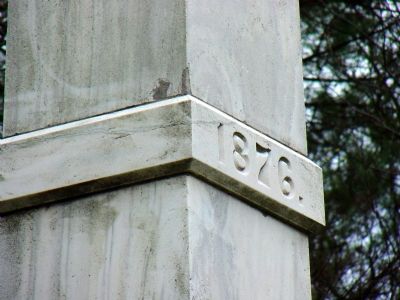
(on a marble band high up on the obelisk) July 4, 1876.
Erected 1876 by State of Maryland.
Topics and series. This historical marker is listed in this topic list: War, US Civil. In addition, it is included in the National Cemeteries series list. A significant historical month for this entry is March 1861.
Location. 38° 4.406′ N, 76° 20.526′ W. Marker is near Scotland, Maryland, in St. Mary's County. It is at the intersection of Point Lookout Road (Maryland Route 5) and St. Michaels Manor Way, on the right when traveling south on Point Lookout Road. Touch for map. Marker is in this post office area: Scotland MD 20687, United States of America. Touch for directions.

Regionally, this marker is in Southern Maryland. It is also in the American South, specifically in the Upper South, in the Mid-Atlantic, in the Tidewater, in the Chesapeake Bay Region, and on the Eastern Seaboard. Globally, it is in the North Atlantic Region, North America, the
Photographed by Tom Fuchs, March 31, 2007
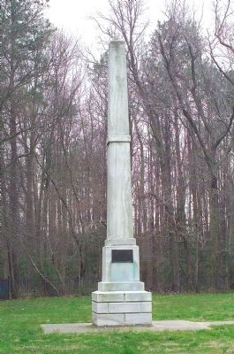
2. State of Maryland Monument
This the north face, facing the road, showing the brass tablet.
Other nearby markers. At least 5 other markers are within walking distance of this marker: Maryland and the Confederacy (a few steps from this marker); a different marker also named Point Lookout Confederate Cemetery (within shouting distance of this marker); a different marker also named Point Lookout Confederate Cemetery (within shouting distance of this marker); Maryland, My Maryland Monument (about 300 feet away, measured in a direct line); Sgt. Bartlett Yancey Malone (about 300 feet away). Touch for a list and map of all markers in Scotland.
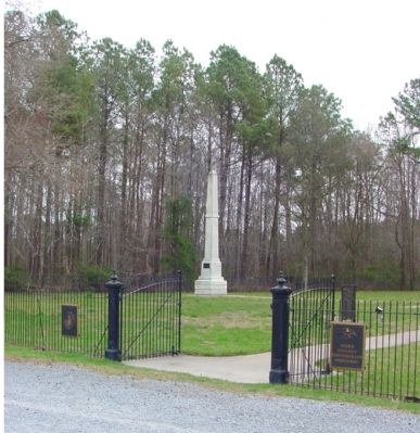
Regarding Point Lookout Confederate Cemetery. There are two monuments at the cemetery, this 1876 monument and the much larger 1911 monument erected by the U.S. Government. The cemetery is maintained by the Veterans Administration.
Photographed by Tom Fuchs, March 31, 2007
3. South Face
Photographed by Tom Fuchs, March 31, 2007
4. East Face
Photographed by J. J. Prats, March 31, 2007
5. North Face
Photographed by J. J. Prats, March 31, 2007
6. Marble Band High Up on the Obelisk
Photographed by J. J. Prats, March 31, 2007
7. View from the Road
Credits. This page was last revised on June 16, 2016. It was originally submitted on April 12, 2007, by Tom Fuchs of Greenbelt, Maryland. This page has been viewed 3,051 times since then and 51 times this year. Photos: 1, 2, 3, 4, 5. submitted on April 12, 2007, by Tom Fuchs of Greenbelt, Maryland. 6. submitted on April 7, 2007, by Tom Fuchs of Greenbelt, Maryland. 7. submitted on April 12, 2007, by J. J. Prats of Powell, Ohio. • J. J. Prats was the editor who published this page.
