Aledo in Parker County, Texas — The American South (West South Central)
Bankhead Highway in Aledo
Photographed by QuesterMark, April 30, 2016
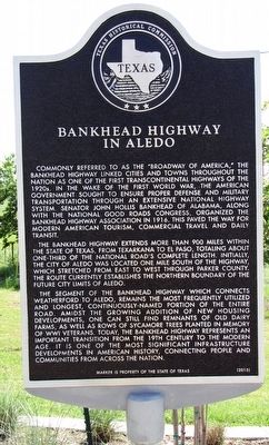
1. Bankhead Highway in Aledo Texas Historical Marker
The Bankhead Highway extends more than 900 miles within the state of Texas, from Texarkana to El Paso, totaling about one-third of the National Road's complete length. Initially, the City of Aledo was located one mile south of the Highway, which stretched from east to west through Parker County. The route currently establishes the northern boundary of the future city limits of Aledo.
The segment of the Bankhead Highway which connects Weatherford to Aledo, remains the most frequently utilized and longest, continuously-named portion of the entire road. Amidst the growing addition of new housing developments, one can still find remnants of old diary farms, as well as rows of sycamore trees planted in memory of WWI veterans. Today, the Bankhead Highway represents an important transition from the 19th century to the modern age. It is one of the most significant infrastructure developments in American History, connecting people and communities from across the nation.
Erected 2015 by Texas Historical Commission. (Marker Number 18203.)
Topics. This historical marker is listed in this topic list: Roads & Vehicles. A significant historical year for this entry is 1916.
Location. 32° 42.923′ N, 97° 36.051′ W.
this page online

Regionally, this marker is in the Prairies & Lakes Region and in the Dallas-Fort Worth Metropolitan Area. Globally, it is in North America, a Gulf of Mexico state, the Western Hemisphere, the Western World, and the Anglosphere. Historically, it finds itself in what was once New Spain, the Republic of Texas, and one of the Confederate States of America.
Other nearby markers. At least 8 other markers are within 6 miles of this marker, measured as the crow flies: First Baptist Church of Aledo (approx. 1.3 miles away); Aledo United Methodist Church (approx. 1.3 miles away); City of Aledo (approx. 1.3 miles away); Hood Family Cemetery (approx. 1.8 miles away); Annetta Cemetery (approx. 4.4 miles away); Lawson Daniel Gratz (approx. 4.8 miles away); Fort Worth-Yuma Mail (approx. 5½ miles away); Chapin School (approx. 5.8 miles away).
Photographed by QuesterMark, April 30, 2016
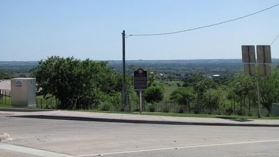
2. Bankhead Highway in Aledo Marker in context
Credits. This page was last revised on July 17, 2020. It was originally submitted on April 30, 2016, by QuesterMark of Fort Worth, Texas. This page has been viewed 1,444 times since then and 141 times this year. Photos: 1, 2. submitted on April 30, 2016, by QuesterMark of Fort Worth, Texas. • Bernard Fisher was the editor who published this page.
