Chenango Forks in Broome County, New York — The American Northeast (Mid-Atlantic)
The Chenango Canal
Photographed by Scott J. Payne, April 30, 2016
1. The Chenango Canal Marker
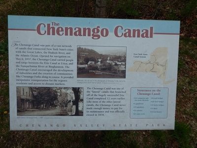
The Chenango Canal was part of a vast network of canals that connected New York State's cities with the Great Lakes, the Hudson River and the Atlantic Ocean. Opened for navigation on May 6, 1837, the Chenango Canal carried people between the Erie Canal at Utica and the Susquehanna River at Binghamton. The Chenango Canal encouraged development of industries and the creation of communities like Chenango Forks along its course. It provided inexpensive transportation for the regions residents and access to distant markets.
The Chenango Canal was one of the "lateral" canals that branched off the hugely successful Erie Canal completed 12 years earlier. Like most of the other lateral canals, the Chenango Canal never made enough money to pay for its maintenance and was officially closed in 1878.
Topics and series. This historical marker is listed in this topic list: Waterways & Vessels. In addition, it is included in the Chenango Canal series list. A significant historical date for this entry is May 6, 1837.
Location. 42° 12.309′ N, 75° 50.274′ W. Marker is in Chenango Forks, New York, in Broome County. It is on Rogers Road, on the
this page online

Regionally, this marker is in Upstate New York and in the Southern Tier. It is also in the American Northeast, in the Mid-Atlantic, in Appalachia, and specifically in Northern Appalachia. Globally, it is in North America, the Western Hemisphere, the Western World, and the Anglosphere. Historically, it finds itself in what was once New Netherland and also one of the original Thirteen Colonies.
Other nearby markers. At least 8 other markers are within 6 miles of this marker, measured as the crow flies: Lock 107 (approx. 2½ miles away); Above the Forks (approx. 3 miles away); Food as Healing (approx. 3 miles
Photographed by Scott J. Payne, April 30, 2016
2. The Chenango Canal Marker
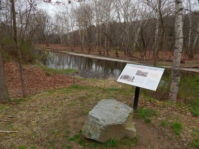
Looking southwest toward the Chenango River.
Photographed by Scott J. Payne, April 30, 2016
3. The Chenango Canal Marker
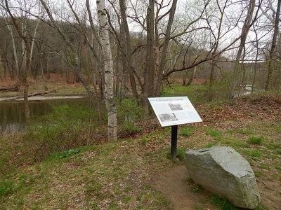
Looking northwest toward the Chenango River.
Photographed by Scott J. Payne, April 30, 2016
4. The Chenango Canal Marker
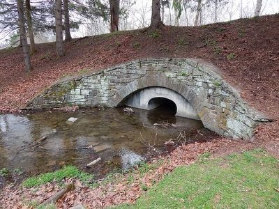
Although the marker makes no reference to it this structure continues its original purpose by allowing water to pass under the road where there once was a canal. The aqueduct under the road was built by Irish stone masons to carry the Chenango Canal over the outflow from Chenango Lake.
A concrete plug has been placed inside the stone arch to prevent any further crumbling.
Photographed by Scott J. Payne, April 30, 2016
5. The Chenango Canal Marker
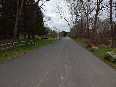
The canal bed is directly below this Chenango Valley State Park road. View is looking south.
Credits. This page was last revised on March 31, 2026. It was originally submitted on May 3, 2016, by Scott J. Payne of Deposit, New York. This page has been viewed 1,211 times since then and 77 times this year. Last updated on March 28, 2026, by Susan A. Dalaba of Cortland, New York. Photos: 1, 2, 3, 4, 5. submitted on May 3, 2016, by Scott J. Payne of Deposit, New York. • Devry Becker Jones was the editor who published this page.
