Chance, Saint John, Dominica — Caribbean Region of the Americas (Lesser Antilles of the West Indies)
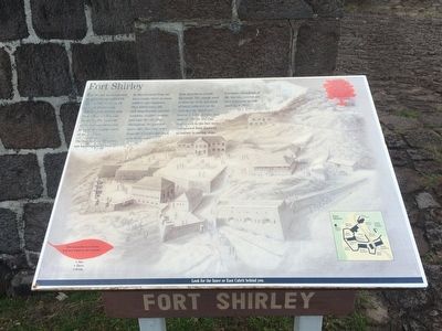
Fort Shirley
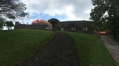
Fort Shirley was positioned between the two hills with a direct line of site (sic, sight) to all parts of the garrison and guarding directly over Prince Rupert's Bay and the dock. The land side of the fort was protected by batteries in other parts of the garrison.
The fort and all the garrison buildings were built by slaves rented from the plantations, white artisans, soldiers and engineers. They felled trees, cut and shaped stone, carried boulders, hauled cannons, and kept the site clear throughout the garrison's active life. Volcanic stone from the hillsides was used, as well as stone from quarries at Grand Savannah. The cement used to bind the walls was made of coral, collected on the reefs nearby, which was heated in kilns to make lime mortar. All the red clay bricks seen in the fort were transported from England as ballast in sailing ships.
Extensive restoration of the fort was carried out over a ten-year period starting in 1982.
Mahogany seeds have wings which enable them to be carried long distances on the wind. As they fly, they spin around like propellers.
How many flavours of bay leaf are found on the Cabrits?
· One
· Three
· Seven
Look for the Inner or East Cabrit behind you.
Topics. This historical marker is listed in these topic lists: Colonial Era • Forts and Castles. A significant historical year for this entry is 1982.
Location. 15° 35.013′ N, 61° 28.393′ W. Marker is in Chance, Saint John. Marker can be reached from Bay Street. The marker is directly before the entrance to the reconstructed Fort Shirley near Chance, Dominica. Touch for map. Touch for directions.
Other nearby markers. At least 8 other markers are within walking distance of this marker. Guard House, Powder Magazine (a few steps from this marker); Cabrits Calendar of Events (a few steps from this marker); The Trees Return (within shouting distance of this marker); Water Catchment, Troops' Kitchen, Stables (within shouting distance of this marker); Officers' Quarters (within shouting distance of this marker); Upper Battery, Signal Station (about 90 meters away, measured in a direct line); Prince Rupert's Garrison (about 90 meters away); Cabrits National Park (about 150 meters away). Touch for a list and map of all markers in Chance.
Credits. This page was last revised on June 16, 2016. It was originally submitted on May 7, 2016, by J. Makali Bruton of Accra, Ghana. This page has been viewed 286 times since then and 12 times this year. Photos: 1, 2. submitted on May 7, 2016, by J. Makali Bruton of Accra, Ghana.

