Queen Creek in Maricopa County, Arizona — The American Mountains (Southwest)
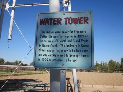
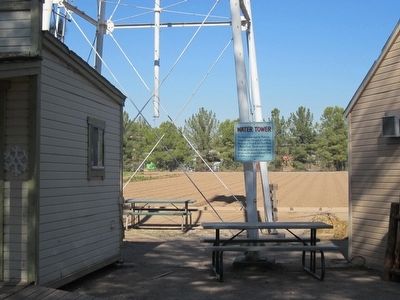
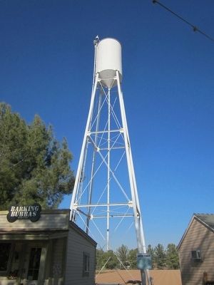
Water Tower
Erected by Schnepf Farms.
Topics. This historical marker is listed in these topic lists: Industry & Commerce • Waterways & Vessels. A significant historical year for this entry is 1952.
Location. 33° 13.452′ N, 111° 35.497′ W. Marker is in Queen Creek, Arizona, in Maricopa County. Marker can be reached from South Rittenhouse Road, on the right when traveling west. Marker and water tower are located on the grounds of Schnepf Farms. Touch for map. Marker is at or near this postal address: 24810 South Rittenhouse Road, Queen Creek AZ 85142, United States of America. Touch for directions.
Other nearby markers. At least 8 other markers are within 14 miles of this marker, measured as the crow flies. 1912 Parker Carousel (about 400 feet away, measured in a direct line); Rittenhouse Elementary School (approx. 3.6 miles away); Engine 1673 (approx. 3.7 miles away); Williams Field Honor Roll, Chandler, Arizona (approx. 7.7 miles away); Military Order Purple Heart of the U.S.A. (approx. 13.3 miles away); Dedicated to the Memory of Matthew B. Juan (approx. 13.3 miles away); Honoring Native American Women Veterans (approx. 13.3 miles away); Dedicated to Ira H. Hayes USMC (approx. 13.3 miles away). Touch for a list and map of all markers in Queen Creek.
Credits. This page was last revised on August 16, 2020. It was originally submitted on May 7, 2016, by Syd Whittle of Mesa, Arizona. This page has been viewed 571 times since then and 57 times this year. Photos: 1, 2, 3. submitted on May 7, 2016, by Syd Whittle of Mesa, Arizona.


