Chance, Saint John, Dominica — Caribbean Region of the Americas (Lesser Antilles of the West Indies)
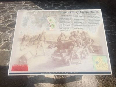
Upper Battery, Signal Station
The garrison at the Cabrits never saw any action, although the Battle of the Saints, fought between the French and British fleets on 12 April 1782, occurred within sight of the ramparts, and Fort Shirley was the scene of the revolt of the 8th West India Regiment in 1802.
In 1805, an attack was mounted by French Napoleonic forces under the command of General LaGrange in an attempt to capture the island. The capital, Roseau, fell to the French but British Governor George Prevost managed to escape and reached the Cabrits where he readied the fort, much as you see in the scene depicted here, and refused to surrender. La Grange, deterred by the stronghold, left the island and sailed north with his squadron.
The flagstaff was part of a signal system along the west coast. Messages were sent up the coast via the points on the map.
The flat isthmus of sand, coral and stone that joins the Cabrits to the mainland was formed naturally, by the tidal action of the sea.
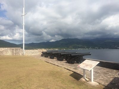
Look across Prince Rupert's Bay at Pointe Ronde, Morne Espagnol and Morne Diablotin.
Topics. This historical marker is listed in these topic lists: Colonial Era • Forts and Castles. A significant historical date for this entry is April 12, 1782.
Location. 15° 34.978′ N, 61° 28.421′ W. Marker is in Chance, Saint John. Marker can be reached from Bay Street. The marker is near the Upper Battery at the reconstructed Fort Shirley. Touch for map. Touch for directions.
Other nearby markers. At least 8 other markers are within walking distance of this marker. Officers' Quarters (a few steps from this marker); Cabrits Calendar of Events (within shouting distance of this marker); Guard House, Powder Magazine (within shouting distance of this marker); Water Catchment, Troops' Kitchen, Stables (within shouting distance of this marker); Fort Shirley (about 90 meters away, measured in a direct line); The Trees Return (about 120 meters away); Cabrits National Park (about 180 meters away); Prince Rupert's Garrison (about 180 meters away). Touch for a list and map of all markers in Chance.
Credits. This page was last revised on June 16, 2016. It was originally submitted on May 7, 2016, by J. Makali Bruton of Accra, Ghana. This page has been viewed 261 times since then and 8 times this year. Photos: 1, 2. submitted on May 7, 2016, by J. Makali Bruton of Accra, Ghana.

