Chance, Saint John, Dominica — Caribbean Region of the Americas (Lesser Antilles of the West Indies)
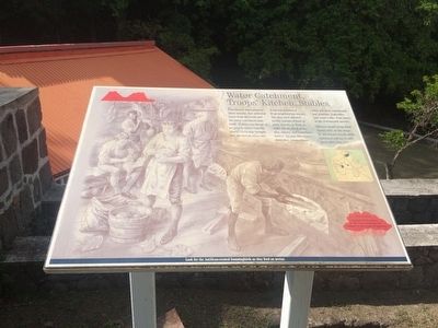
Water Catchment, Troops' Kitchen, Stables
Inscription.
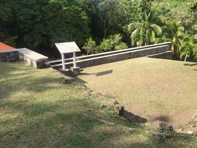
Fort Shirley was served by three cisterns that collected water from the roofs and the water catchment platform. If there was threat of an attack, water from the nearby rivers was brought into the fort by oxen cart.
Food was purchased from neighbouring estates. The men were allowed weekly rations of beef or pork, biscuit, or flour to make bread, dried peas, rice raisins, and sometimes butter. To vary this repetitious diet, troops would often sell their rations and buy plantain, vegetables and roast coffee from slaves in the Portsmouth market.
Officers would bring their horses over on the ships or buy horses locally while stationed and try to sell them when they left.
The twin hills of the Cabrits were formed by volcanic activity.
True or False: Rainfall (60-70 inches) in this zone is relatively low compared to other parts of Dominica.
Look for the Antillean-crested hummingbirds as they feed on nectar.
Topics. This historical marker is listed in these topic lists: Colonial Era • Forts and Castles.
Location. 15° 35.019′ N, 61° 28.418′ W. Marker is in Chance, Saint John. Marker can be reached from Bay Street. The marker is to the right of the Officers' Quarters area. Touch for map. Touch for directions.
Other nearby markers. At least 8 other markers are within walking distance of this marker. Guard House, Powder Magazine (within shouting distance of this marker); Cabrits Calendar of Events (within shouting distance of this marker); Fort Shirley (within shouting distance of this marker); Officers' Quarters (within shouting distance of this marker); The Trees Return (within shouting distance of this marker); Upper Battery, Signal Station (within shouting distance of this marker); Prince Rupert's Garrison (about 120 meters away, measured in a direct line); Cabrits National Park (about 180 meters away). Touch for a list and map of all markers in Chance.
Credits. This page was last revised on June 16, 2016. It was originally submitted on May 7, 2016, by J. Makali Bruton of Accra, Ghana. This page has been viewed 277 times since then and 7 times this year. Photos: 1, 2. submitted on May 7, 2016, by J. Makali Bruton of Accra, Ghana.

