
Near Harpster in Wyandot County, Ohio — The American Midwest (Great Lakes)
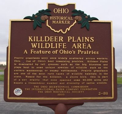
Killdeer Plains Wildlife Area
A Feature of Ohio's Prairies
Photographed by Dale K. Benington, May 4, 2016
1. Killdeer Plains Wildlife Area Marker
Erected 2003 by Ohio Bicentennial Commission, The International Paper Company Foundation, and The Ohio Historical Society. (Marker Number 5-88.)
Topics and series. This historical marker is listed in this topic list: Environment. In addition, it is included in the Ohio Historical Society / The Ohio History Connection series list.
Location. 40° 42.899′ N, 83° 17.982′ W. Marker is near Harpster, Ohio, in Wyandot County. It is on County Route 115 south of County Route 71. This marker is located south of Upper Sandusky and west of Harpster, in the
this page online

Regionally, this marker is in Ohio’s Till Plains. It is also in the American Midwest and in the Corn Belt. Globally, it is in North America, the Western Hemisphere, the Western World, and the Anglosphere. Historically, it finds itself in what was once the Viceroyalty of New France, the Haudenosaunee (Iroquois) Confederacy, the territory of the Mississippian Culture, and the Northwest Territory.
Other nearby markers. At least 8 other markers are within 8 miles of this marker, measured as the crow flies: to Fort Morrow / to Fort Ferree (approx. 5.3 miles away); Upper Sandusky (approx. 5.9 miles away); a different marker also named Upper Sandusky (approx. 7 miles away); Bardon School (approx. 7.1 miles away); Stephan Lumber Company / “The Shawshank Redemption” Woodshop (approx.
Photographed by Dale K. Benington, May 4, 2016
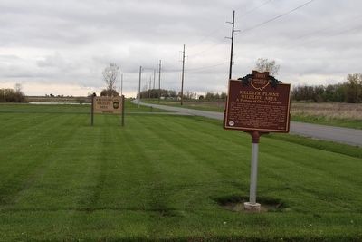
2. Killdeer Plains Wildlife Area Marker
View of the marker looking north along County Route 115.
Photographed by Dale K. Benington, May 4, 2016
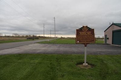
3. Killdeer Plains Wildlife Area Marker
View of the marker looking south along County Route 115.
Credits. This page was last revised on June 16, 2016. It was originally submitted on May 9, 2016, by Dale K. Benington of Toledo, Ohio. This page has been viewed 1,067 times since then and 69 times this year. Photos: 1, 2, 3. submitted on May 9, 2016, by Dale K. Benington of Toledo, Ohio.
