Richmond in Contra Costa County, California — The American West (Pacific Coastal)
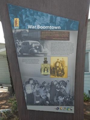
War Boomtown
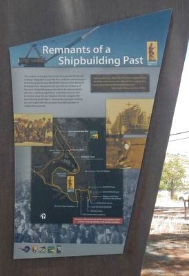
Remnants of a Shipbuilding Past
As World War II approached, Richmond was a sleepy city of some 23,000 residents. Beginning in early 1941, however, the town underwent a radical transformation. This was a prime site for wartime production: the Santa Fe Rail line was already here, the expansive waterfront offered a deep water port, and there was plenty of available land. As shipyards were constructed, the population boomed to over 100,000. People came from all over the country to find jobs and to support the war effort.
"It was a town that grew up overnight. It wasn't there and then all of a sudden it was there, bright lights everywhere, day and night, all the time." -- Altha Humphrey, telephone operator
"During that time, they had all of these shipyards here, and they came out to work. Most of them stayed; they never went back to where they came from." -- Viola Taylor Wims, wartime realtor
This section of the Bay Trail winds through the former site of Kaiser Shipyard #3, now the Port of Richmond and a part of the Rosie the Riveter/World War II Home Front National Historical Park. Along the trail, you will see evidence of the war’s shipbuilding past: dry docks for ship assembly, rail lines, maritime machinery, a whirley crane, as well as historic ships. As you traverse the trail, imagine this place during World War II–thousands of people working day and night with the constant thundering noise of shipbuilding activity.
Erected by National Park Service and East Bay Regional District.
Topics. This historical marker is listed in these topic lists: Industry & Commerce • War, World II • Waterways & Vessels.
Location. 37° 54.805′ N, 122° 22.157′ W. Marker is in Richmond, California, in Contra Costa County. Marker is on Canal Boulevard near Seacliff Drive, on the right when traveling south. Touch for map. Marker is at or near this postal address: 1303 Canal Boulevard, Richmond CA 94801, United States of America. Touch for directions.
Other nearby markers. At least 8 other markers are within walking distance of this marker. Wartime Changes (within shouting distance of this marker); Contra Costa College Site (within shouting distance of this marker); Richmond Shipyards (within shouting distance of this marker); Dynamic Wartime Port (approx. ¼ mile away); Clay, Kilns & Brick (approx. 0.6 miles away); SS Red Oak Victory (approx. 0.6 miles away); "I was truly there and did my part to the end." -- Addie Mae Cance, former shipyard worker (approx. 0.6 miles away); The Ford Assembly Building (approx. 0.7 miles away). Touch for a list and map of all markers in Richmond.
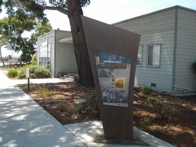
More about this marker. This marker is located in front of the Shipyard 3 cafeteria, a part of the Rosie the Riveter/Home Front National Historic Park.
Credits. This page was last revised on June 16, 2016. It was originally submitted on May 22, 2016, by Barry Swackhamer of Brentwood, California. This page has been viewed 401 times since then and 21 times this year. Photos: 1, 2, 3. submitted on May 22, 2016, by Barry Swackhamer of Brentwood, California.


