Near Williamsburg in James City County, Virginia — The American South (Mid-Atlantic)
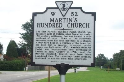
Martin's Hundred Church
Erected 1998 by Department of Historic Resources. (Marker Number W-52.)
Topics and series. This historical marker is listed in these topic lists: Churches & Religion • Colonial Era • Settlements & Settlers. In addition, it is included in the Virginia Department of Historic Resources (DHR) series list. A significant historical year for this entry is 1630.
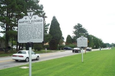
Location. 37° 12.612′ N, 76° 36.969′ W. Marker is near Williamsburg, Virginia, in James City County. Marker is on Pocahontas Trail (Virginia Route 60) 0.1 miles east of Plantation Road, on the right. Located with Martin's Hundred (W 51) marker. Touch for map. Marker is in this post office area: Williamsburg VA 23185, United States of America. Touch for directions.
Other nearby markers. At least 8 other markers are within 3 miles of this marker, measured as the crow flies. Martin's Hundred (here, next to this marker); Trebell's Landing (about 500 feet away, measured in a direct line); Carter's Grove (about 500 feet away); Community of Grove (approx. 0.9 miles away); The Reservation (approx. 1.8 miles away); Homestead by the Main Road (approx. 2.3 miles away); Master and Slaves (approx. 2.3 miles away); Loch Ness Coaster (approx. 2.3 miles away). Touch for a list and map of all markers in Williamsburg.
Credits. This page was last revised on February 28, 2021. It was originally submitted on July 24, 2008, by Kathy Walker of Stafford, Virginia. This page has been viewed 1,568 times since then and 33 times this year. Photos: 1, 2. submitted on July 24, 2008, by Kathy Walker of Stafford, Virginia. • Christopher Busta-Peck was the editor who published this page.

