Rocky Mount in Nash County, North Carolina — The American South (South Atlantic)
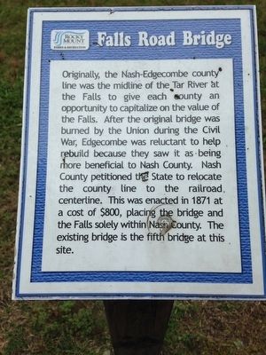
Falls Road Bridge
Erected by Rocky Mount Parks & Recreation.
Topics. This historical marker is listed in these topic lists: Bridges & Viaducts • War, US Civil. A significant historical year for this entry is 1871.
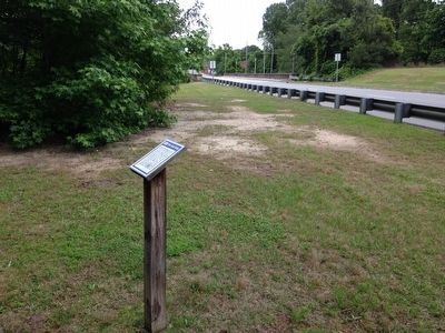
Location. 35° 57.668′ N, 77° 48.284′ W. Marker is in Rocky Mount, North Carolina, in Nash County. Marker can be reached from the intersection of Falls Road (State Highway 43) and Peachtree Street (State Highway 48), on the right when traveling north. Located in Falls park along hiking trail. Touch for map. Marker is in this post office area: Rocky Mount NC 27804, United States of America. Touch for directions.
Other nearby markers. At least 8 other markers are within one mile of this marker, measured as the crow flies. Lafayette (within shouting distance of this marker); Donaldson's Tavern (within shouting distance of this marker); First Post Office of Rocky Mount (about 700 feet away, measured in a direct line); Rocky Mount Mills (approx. 0.2 miles away); Rocky Mount Mills School (approx. ¼ mile away); Falls of the Tar Church (approx. 0.3 miles away); P.T. Barnum (approx. 0.9 miles away); Operation Dixie (approx. one mile away). Touch for a list and map of all markers in Rocky Mount.
Also see . . . Falls Road historical District. (Submitted on June 1, 2016, by Charles T. Harrell of Woodford, Virginia.)
Credits. This page was last revised on June 16, 2016. It was originally submitted on June 1, 2016, by Charles T. Harrell of Woodford, Virginia. This page has been viewed 480 times since then and 23 times this year. Photos: 1, 2. submitted on June 1, 2016, by Charles T. Harrell of Woodford, Virginia. • Bernard Fisher was the editor who published this page.

