Rustic in Charles City County, Virginia — The American South (Mid-Atlantic)
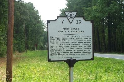
Piney Grove and E. A. Saunders
Erected 1983 by Department of Conservation and Historic Resources. (Marker Number V-23.)
Topics and series. This historical marker is listed in these topic lists: Agriculture • Architecture • Roads & Vehicles • Settlements & Settlers. In addition, it is included in the Virginia Department of Historic Resources (DHR) series list. A significant historical year for this entry is 1800.
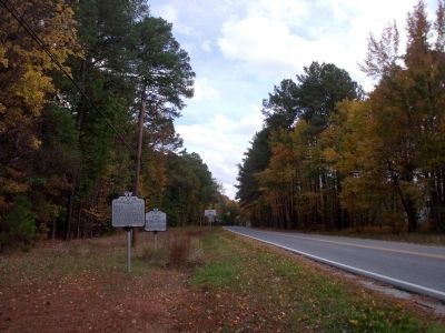
Location. 37° 17.502′ N, 76° 55.989′ W. Marker is in Rustic, Virginia, in Charles City County. Marker is on John Tyler Memorial Highway (Virginia Route 5) 0.1 miles east of Willcox Neck Road (Route 623), on the right when traveling west. Touch for map. Marker is in this post office area: Charles City VA 23030, United States of America. Touch for directions.
Other nearby markers. At least 8 other markers are within 5 miles of this marker, measured as the crow flies. Paspahegh Indians (a few steps from this marker); Sandy Point & Cherry Hall (approx. 2.1 miles away); Mt. Zion & Rustic (approx. 2˝ miles away); Paspahegh (approx. 3.8 miles away); Wowinchapuncke (approx. 3.9 miles away); Kennon's Landing (approx. 4.1 miles away); Sherwood Forest (approx. 4.1 miles away); Sturgeon Point & Kennons (approx. 4.1 miles away).
Credits. This page was last revised on December 24, 2019. It was originally submitted on July 24, 2008, by Kathy Walker of Stafford, Virginia. This page has been viewed 1,039 times since then and 47 times this year. Photos: 1. submitted on July 24, 2008, by Kathy Walker of Stafford, Virginia. 2. submitted on October 24, 2009, by Bernard Fisher of Richmond, Virginia. • Christopher Busta-Peck was the editor who published this page.

