Near Dadeville in Tallapoosa County, Alabama — The American South (East South Central)
Woods Presbyterian Church
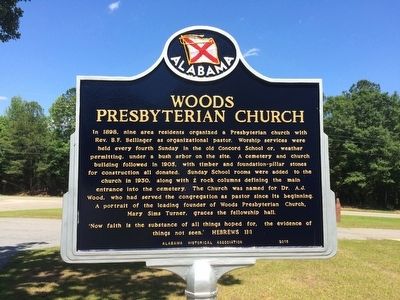
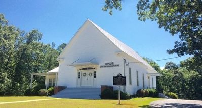
In 1898, nine area residents organized a Presbyterian church with Rev. B.F. Bellinger as organizational pastor. Worship services were held every fourth Sunday in the old Concord School or, weather permitting, under a bush arbor on the site. A cemetery and church building followed in 1905, with timber and foundation-pillar stones for construction all donated. Sunday School rooms were added to the church in 1930, along with 2 rock columns defining the main entrance into the cemetery. The Church was named for Dr. A.J. Wood, who had served the congregation as pastor since its beginning. A portrait of the leading founder of Woods Presbyterian Church, Mary Sims Turner, graces the fellowship hall.
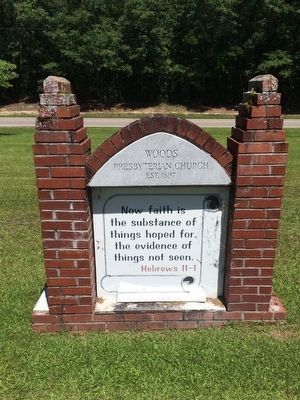
'Now faith is the substance of all things hoped for, the evidence of things not seen.' HEBREWS 11:1
Erected 2015 by Alabama Historical Association.
Topics and series. This historical marker is listed in these topic lists: Cemeteries & Burial Sites • Churches & Religion. In addition, it is included in the Alabama Historical Association series list. A significant historical year for this entry is 1898.
Location. 32° 53.689′ N, 85° 46.186′ W. Marker is near Dadeville, Alabama, in Tallapoosa County. Marker is at the intersection of Horseshoe Bend Road (Alabama Route 49) and Church Road, on the right when traveling south on Horseshoe Bend Road. Touch for map. Marker is at or near this postal address: 1627 Church Road, Dadeville AL 36853, United States of America. Touch for directions.
Other nearby markers. At least 8 other markers are within 5 miles of this marker, measured as the crow flies. Horseshoe Bend Battle Ground (approx. 3.4 miles away); Carnation Milk Plant (approx. 4.1 miles away); Grafenberg Medical Institute (approx. 4.3 miles away); Tallapoosa County High School (approx. 4.3 miles away); Dennis Hotel (approx. 4.3 miles away); Dadeville Coca-Cola Company (approx. 4.4 miles away); Historic Dadeville (approx. 4.4 miles away); Johnson J. Hooper (approx. 4.4 miles away). Touch for a list and map of all markers in Dadeville.
Credits. This page was last revised on March 20, 2020. It was originally submitted on June 9, 2016, by Mark Hilton of Montgomery, Alabama. This page has been viewed 560 times since then and 39 times this year. Photos: 1, 2, 3. submitted on June 9, 2016, by Mark Hilton of Montgomery, Alabama.


