Cheyenne in Laramie County, Wyoming — The American West (Mountains)
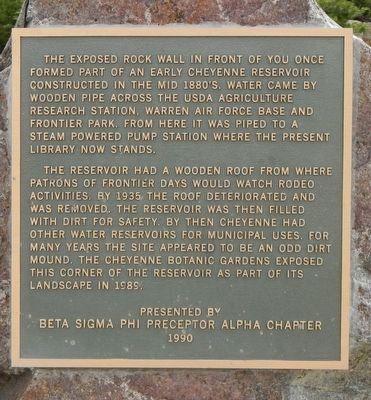
Early Cheyenne Reservoir
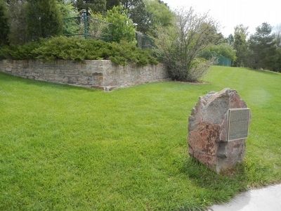
The reservoir had a wooden roof from where patrons of the Frontier Days would watch rodeo activities. By 1935 the roof deteriorated and was removed. The reservoir was then filled with dirt for safety. By then Cheyenne has other water reservoirs for municipal uses. For many years the site appeared to be an odd dirt mound. The Cheyenne Botanic Gardens exposed this corner of the reservoir as part of its landscape in 1989.
Erected 1990 by Beta Sigma Phi Preceptor Alpha Chapter.
Topics. This historical marker is listed in this topic list: Man-Made Features. A significant historical year for this entry is 1935.
Location. 41° 9.377′ N, 104° 49.913′ W. Marker is in Cheyenne, Wyoming, in Laramie County. Marker is on Carey Avenue near South Lions Park Drive, on the right when traveling north. Touch for map. Marker is at or near this postal address: 4401 Carey Avenue, Cheyenne WY 82001, United States of America. Touch for directions.
Other nearby markers. At least 8 other markers are within walking distance of this marker. Union Pacific Steam Engine #1242 (about 500 feet away, measured in a direct line); Cheyenne Frontier Days™ (Part I) (about 600 feet away); Floyd and Edna Young Folk Art Fence (about 600 feet away); The Trails (Part I) (about 600 feet away); Cheyenne Frontier Days™ (Part II) (about 600 feet away); The Trails (Part III) (about 700 feet away); The Trails (Part II) (about 700 feet away); Fort Laramie Trail (approx. 0.4 miles away). Touch for a list and map of all markers in Cheyenne.
More about this marker. This marker is located in Lions Park near the Botanic Garden.
Credits. This page was last revised on June 16, 2016. It was originally submitted on June 16, 2016, by Barry Swackhamer of Brentwood, California. This page has been viewed 292 times since then and 9 times this year. Photos: 1, 2. submitted on June 16, 2016, by Barry Swackhamer of Brentwood, California.

