Fredericksburg, Virginia — The American South (Mid-Atlantic)
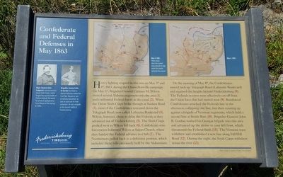
Confederate and Federal Defenses in May 1863
Fredericksburg: Timeless.
Inscription.
Heavy fighting erupted in this area on May 3rd and 4th, during the Chancellorsville campaign. On May 3rd, Brigadier General Cadmus M. Wilcox moved several Alabama regiments into the area (1) and confronted Federal forces at this canal (2). When the Union Sixth Corps broke through at Sunken Road (3), most of the Confederates retreated down the Telegraph Road, now called Lafayette Boulevard (4). Wilcox, however, chose to delay the Federals as they advanced out of Fredericksburg (5). The Sixth Corps pushed west as Wilcox fell back (6). Confederate reinforcements bolstered Wilcox at Salem Church, where they battled the Federal advance to a halt (7). The Northerners pulled back to a defensive position, which included these hills previously held by the Alabamians.
On the morning of May 4th, the Confederates moved back up Telegraph Road (Lafayette Boulevard) and regained the heights behind Fredericksburg (8). The Federals in town were effectively cut off from the Union force that had moved west (9). Reinforced Confederates attacked the Federals late in the afternoon, collapsing one line, but then running up against a brigade of Vermont regiments, which held at second line at Smith Run (10). Brigadier General John B. Gordon worked his Georgia brigade into this area and advanced up the ravine to your left front, which threatened the Federal flank (11). The Vermont men withdrew and established a new line along Fall Hill Road (12). During the night, the Sixth Corps withdrew across the river (13).
(captions)
Major General John Sedgwick commanded the Union Sixth Corps, which fought the second battle of Fredericksburg. He would be killed at Spotsylvania Court House in the spring of 1864.
Brigadier General John B. Gordon had been a Georgia Attorney before the Civil War. Despite a lack of military education, he had an aptitude for field command. He led a brigade at the second battle of Fredericksburg.
May 3, 1863.
These maps show modern the road network to help orient this battle action to the ground.
May 4, 1863.
Erected by Fredericksburg Economic Development and Tourism Office.
Topics and series. This historical marker is listed in this topic list: War, US Civil. In addition, it is included in the Virginia, Fredericksburg: Timeless. series list. A significant historical date for this entry is May 3, 1863.
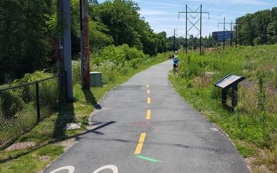
Location. 38° 18.98′ N, 77° 29.159′ W. Marker is in Fredericksburg, Virginia. Marker can be reached from the intersection of Fall Hill Avenue (Virginia Route 639) and Normandy Avenue, on the left when traveling north. Located along the Rappahannock Canal Path. Touch for map. Marker is at or near this postal address: 3219 Fall Hill Ave, Fredericksburg VA 22401, United States of America. Touch for directions.
Other nearby markers. At least 8 other markers are within walking distance of this marker. Confederate Defenses in December 1862 (a few steps from this marker); Rappahannock River Heritage Trail (within shouting distance of this marker); A Once Promising Canal Becomes a Raceway (within shouting distance of this marker); Fall Hill Road (approx. 0.2 miles away); Tactical Terrain (approx. 0.2 miles away); Industrial Interlude (approx. 0.3 miles away); Embrey Dam (approx. 0.4 miles away); Falls of the Rappahannock River (approx. 0.4 miles away). Touch for a list and map of all markers in Fredericksburg.
Credits. This page was last revised on February 2, 2023. It was originally submitted on June 20, 2016, by Bernard Fisher of Richmond, Virginia. This page has been viewed 428 times since then and 15 times this year. Photos: 1, 2. submitted on June 20, 2016, by Bernard Fisher of Richmond, Virginia.

