Fredericksburg, Virginia — The American South (Mid-Atlantic)
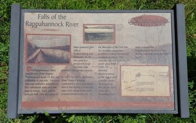
Falls of the Rappahannock River
In 1854-55, the Fredericksburg Water Power Company constructed a stone and timber dam in this vicinity to raise the water level and generate more pressure for industrial use. In the aftermath of the Civil War, this available waterpower provided a critical resource for economic recovery. The concrete dam and hydroelectric power plant (built 1909-10) provided electrical power to the region until a nuclear power plant came on line on the North Anna River. Removing these dams restored the Rappahanock River to a free-flowing waterway along its entire length.
(captions)
The crib dam altered a navigation canal to a raceway that subsequently powered several local mills and industries. It remained in use until 1910, when it was inundated behind the larger Embry Dam.
This 1910 photo shows the 1850 crib dam as it looked during construction of the concrete Embry Dam.
A flood in 1889 collapsed the far end of the crib dam and the rushing water caused considerable erosion. The gouged out riverbank remains evident today.
The power company incorporated a stone canal lock into the dam abutment, which allowed for continued navigation. It was used intermittently into the twentieth century.
Topics. This historical marker is listed in these topic lists: Industry & Commerce • Man-Made Features • Settlements & Settlers • Waterways & Vessels.
Location. 38° 19.255′ N, 77° 29.383′ W. Marker is in Fredericksburg, Virginia. Marker can be reached from the intersection of Fall Hill Avenue (Virginia Route 639) and Tyler Street, on the right when traveling north. Located 0.4 miles upriver on the old Embry Dam Trail. Touch for map. Marker is at or near this postal address: 3219 Fall Hill Ave, Fredericksburg VA 22401, United States of America. Touch for directions.
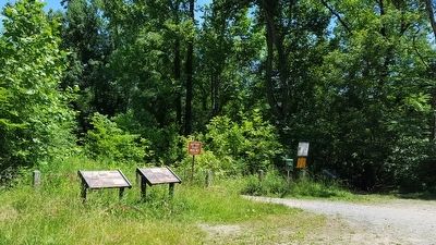
Other nearby markers. At least 8 other markers are within walking distance of this marker. Embrey Dam (here, next to this marker); The Rappahannock River Runs Free Once More (a few steps from this marker); A Once Promising Canal Becomes a Raceway (approx. 0.3 miles away); Fall Hill Road (approx. 0.4 miles away); Tactical Terrain (approx. 0.4 miles away); Confederate Defenses in December 1862 (approx. 0.4 miles away); Confederate and Federal Defenses in May 1863 (approx. 0.4 miles away); Rappahannock River Heritage Trail (approx. 0.4 miles away). Touch for a list and map of all markers in Fredericksburg.
Credits. This page was last revised on February 2, 2023. It was originally submitted on June 20, 2016, by Bernard Fisher of Richmond, Virginia. This page has been viewed 1,000 times since then and 123 times this year. Photos: 1, 2. submitted on June 20, 2016, by Bernard Fisher of Richmond, Virginia.

