Catawba in Chester County, South Carolina — The American South (South Atlantic)
Landsford Canal State Park Trails
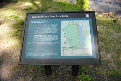
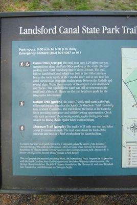
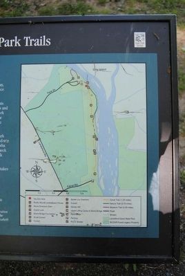
Canal Trail (orange) This trail is an easy 1.25 miles one way, starting from either the Park Office parking or the south entrance parking area. Total round-trip time is about 2 hours. The trail follows Landsford Canal, which was built in the 19th century to bypass the rocky rapids of the Catawba River, and at one time this canal served as an important trading route between the foothills and coastal plain. Today, the remnants of the original canal stonework and "locks" that equalized the water can still be seen toward the south end of the trail. Please see the trail brochure guide for the interpretive information.
Nature Trail (green) This easy 0.75 mile trail starts at the Park Office parking and it ends at the Spider Lily Overlook. Total round-trip time is about 45 minutes. The trail follows the banks of the Catawba River providing many river and wildlife viewing opportunities. Check with park personnel about seeing nesting eagles during your walk and/or the Rocky Shoals Spider Lilies when in bloom.
Museum Trail (purple) This trail is 0.25 mile one way and takes about 15 minutes to walk. The trail leaves from the back of the museum and ends at a bluff overlooking the Catawba River.
Erected by South Carolina State Park Service.
Topics. This historical marker is listed in these topic lists: Industry & Commerce • Man-Made Features • Waterways & Vessels.
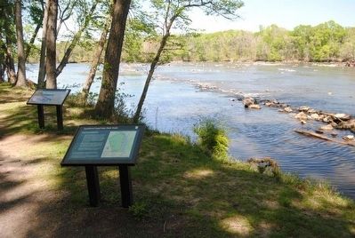
Location. 34° 47.45′ N, 80° 52.783′ W. Marker is in Catawba, South Carolina, in Chester County. Marker can be reached from Park Drive. Marker is near the northern end of the trail. Touch for map. Marker is at or near this postal address: 2051 Park Drive, Catawba SC 29704, United States of America. Touch for directions.
Other nearby markers. At least 10 other markers are within 2 miles of this marker, measured as the crow flies. The Guardlock (within shouting distance of this marker); The Dam (within shouting distance of this marker); A Nest with a Bird's-Eye View (about 600 feet away, measured in a direct line); Welcome to Landsford Canal State Park (about 600 feet away); Landsford Canal (approx. 0.2 miles away); Footbridge (approx. 0.4 miles away); Culvert (approx. 0.7 miles away); The Canal Bed (approx. 0.8 miles away); Mill Complex (approx. one mile away); Great Indian Warrior Trading Path (approx. 1.3 miles away). Touch for a list and map of all markers in Catawba.
Also see . . . Landsford Canal State Park. Landsford Canal State Park is a South Carolina state park located in Chester County, two miles from US 21. The 448-acre park contains the ruins of the Landsford Canal built to bypass rapids on the Catawba River using slave labor between 1820 and 1825. The coming of the railroad caused the canal to be abandoned. (Submitted on June 26, 2016, by Brian Scott of Anderson, South Carolina.)
Credits. This page was last revised on November 14, 2020. It was originally submitted on June 26, 2016, by Brian Scott of Anderson, South Carolina. This page has been viewed 384 times since then and 29 times this year. Photos: 1, 2, 3, 4. submitted on June 26, 2016, by Brian Scott of Anderson, South Carolina.


