Near Alcova in Natrona County, Wyoming — The American West (Mountains)
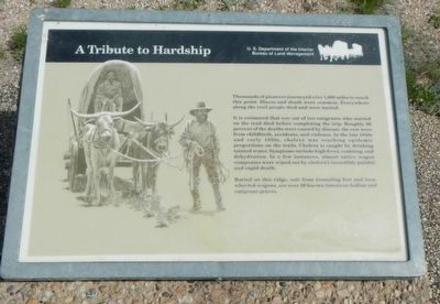
A Tribute to Hardship
It is estimated that one out of ten emigrants who started on the trail died before completing the trip. Roughly 90 percent of the deaths were caused by disease, the rest were from childbirth, accidents, and violence. In the late 1840s and early 1850s, cholera was reaching epidemic proportions on the trails. Cholera is caught by drinking tainted water. Symptoms include high fever, vomiting, and dehydration. In a few instances, almost entire wagon companies were wiped out by cholera's incredibly painful and rapid death.
Buried on this ridge, safe from tramping feet and iron-wheeled wagons are over 20 known American Indian and emigrant graves.
Erected by U.S. Department of the Interior, Bureau of Land Management.
Topics and series. This historical marker is listed in these topic lists: Cemeteries & Burial Sites • Settlements & Settlers. In addition, it is included in the Oregon Trail series list.
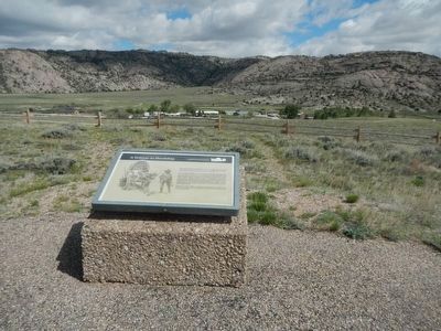
Location. 42° 26.314′ N, 107° 13.02′ W. Marker is near Alcova, Wyoming, in Natrona County. Marker is on State Highway 220 near Martin Cove Road, on the right when traveling west. Touch for map. Marker is in this post office area: Alcova WY 82620, United States of America. Touch for directions.
Other nearby markers. At least 8 other markers are within walking distance of this marker. The Emigrant Road (about 300 feet away, measured in a direct line); Sun Ranch (about 300 feet away); Following the River (about 400 feet away); Devil's Gate (about 500 feet away); Martin's Cove (about 500 feet away); Tom Sun Ranch (approx. ¼ mile away); The Oregon Trail (approx. ¼ mile away); The Pioneer Women (approx. ¼ mile away). Touch for a list and map of all markers in Alcova.
More about this marker. This marker is located at the Devil's Gate BLM Interpretive Site, approximately 7 miles southwest of Independence Rock.
Credits. This page was last revised on June 29, 2016. It was originally submitted on June 29, 2016, by Barry Swackhamer of Brentwood, California. This page has been viewed 438 times since then and 12 times this year. Photos: 1, 2. submitted on June 29, 2016, by Barry Swackhamer of Brentwood, California.

