Parramos, Chimaltenango, Guatemala — Central America
The 20th Anniversary of the Guatemalan Peace Accords
Photographed by J. Makali Bruton, July 2, 2016
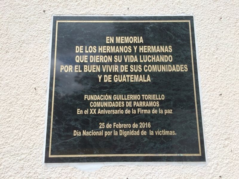
1. The 20th Anniversary of the Guatemalan Peace Accords Marker

de los hermanos y hermanas
que dieron su vida luchando
por el buen vivir de sus comunidades
y de Guatemala
Fundación Guillermo Toriello
Comunidades de Parramos
En el XX Aniversario de la Firma de la paz
25 de Febrero de 2016
Día Nacional por la Dignidad de la víctimas.
that gave their lives struggling
for a better life for their communities
and for Guatemala
Guillermo Toriello Foundation
Communities of Parramos
On the 20th Anniversary of the Signing of the Peace Accords
February 25, 2016
National Day of Dignity for the Victims of the Guatemalan Conflict
Erected 2016 by Fundación Guillermo Toriello y Comunidades de Parramos.
Topics. This memorial is listed in these topic lists: Patriots & Patriotism • Peace • Wars, Non-US.
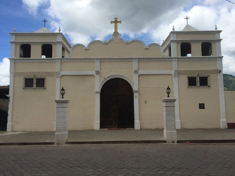
Location. 14° 36.569′ N, 90° 48.108′ W. Memorial is in Parramos, Chimaltenango. It is on 1a Avenida Poniente close to 1a Calle Sur, on the right when traveling north. The marker is just to the east of the Parramos central park, on the front of the Catholic church. Touch for map.
this page online

Regionally, it is in North America, specifically in Central America, in Mesoamerica, on the Ring of Fire, in the Pacific Rim, and in the Western Hemisphere. Historically, it finds itself in what was once New Spain and also a Spanish colony.
Other nearby markers. At least 8 other markers are within 8 kilometers of this marker, measured as the crow flies: Saint Sebastian Catholic Church of El Tejar (approx. 4.2 kilometers away); Canadian Assistance after the 1976 Earthquake (approx. 4.9 kilometers away); General Justo Rufino Barrios (approx. 6 kilometers away); José Simeon Cañas (approx. 6 kilometers away); Chimaltenango Memorial to the Victims of Guatemala's Armed Conflict (approx. 6.1 kilometers away); Santa Catarina Barahona (approx. 6.6 kilometers away in Sacatepéquez); Tragic Accident in San Antonio Aguas Calientes (approx. 7.3 kilometers away in Sacatepéquez); Tree of Saint Peter (approx. 8.2 kilometers away in Sacatepéquez).
Photographed by J. Makali Bruton, July 2, 2016
2. The 20th Anniversary of the Guatemalan Peace Accords Marker
The marker is on the far right of the Catholic church of Parramos, Chimaltenango.
Credits. This page was last revised on March 2, 2018. It was originally submitted on July 9, 2016, by J. Makali Bruton of Washington, District of Columbia. This page has been viewed 572 times since then and 6 times this year. Photos: 1, 2. submitted on July 9, 2016, by J. Makali Bruton of Washington, District of Columbia.
