Sweetwater Station in Fremont County, Wyoming — The American West (Mountains)
The Sweetwater Valley
Photographed by Barry Swackhamer, May 29, 2016
1. The Sweetwater Valley Marker
Inscription.
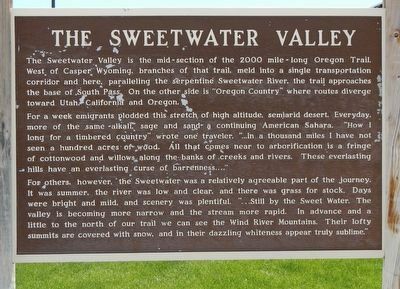
The Sweetwater Valley is the mid-section of the 2000 mile-long Oregon Trail. West of Casper, Wyoming, branches of that trail, meld into a single transportation corridor and here, paralleling the serpentine Sweetwater River, the trail approaches the base of South Pass. On the other side is "Oregon Country" where routes diverge toward Utah, California and Oregon. For a week emigrants plodded this stretch of high altitude, semiarid desert. Everyday, more of the same - alkali, sage and sand - a continuing American Sahara. "How I long for a timbered country" wrote one traveler. "...In a thousand miles I have not seen a hundred acres of wood. All that comes near to arborification is a fringe of cottonwood and willows along the banks of creeks and rivers. These everlasting hills have an everlasting curse of barrenness...." For others, however, the Sweetwater was a relatively agreeable part of the journey. It was summer, the river was low and clear, and there was grass for stock. Days were bright and mild, and scenery was plentiful. "...Still by the Sweet Water. The valley is becoming more narrow and the stream more rapid. In advance and a little to the north of our trail we can see the Wind River Mountains. Their lofty summits are covered with snow, and in their dazzling whiteness appear truly sublime."
The Sweetwater Valley is the mid-section of the 2000 mile-long Oregon Trail. West of Casper, Wyoming, branches of that trail, meld into a single transportation corridor and here, paralleling the serpentine Sweetwater River, the trail approaches the base of South Pass. On the other side is "Oregon Country" where routes diverge toward Utah, California and Oregon. For a week emigrants plodded this stretch of high altitude, semiarid desert. Everyday, more of the same - alkali, sage and sand - a continuing American Sahara. "How I long for a timbered country" wrote one traveler. "...In a thousand miles I have not seen a hundred acres of wood. All that comes near to arborification is a fringe of cottonwood and willows along the banks of creeks and rivers. These everlasting hills have an everlasting curse of barrenness...." For others, however, the Sweetwater was a relatively agreeable part of the journey. It was summer, the river was low and clear, and there was grass for stock. Days were bright and mild, and scenery was plentiful. "...Still by the Sweet Water. The valley is becoming more narrow and the stream more rapid. In advance
Click or scan to see this page online
and a little to the north of our trail we can see the Wind River Mountains. Their lofty summits are covered with snow, and in their dazzling whiteness appear truly sublime."
Erected by Wyoming State Parks and Cultural Resources.
Location. 42° 32.656′ N, 108° 11.307′ W. Marker is in Sweetwater Station, Wyoming, in Fremont County. It can be reached from the intersection of Wyoming 789 (U.S. 287) and Sand Draw Road (Wyoming Highway 135), on the right when traveling west. Touch for map. Marker is at or near this postal address: 4189 Wyoming 789, Lander WY 82520, United States of America. Touch for directions.

Regionally, this marker is in Wind River Country. It is also in the American Mountain West. Globally, it is in North America, the Rocky Mountains, the Western Hemisphere, the Western World, and the Anglosphere.
Other nearby markers. At least 8 other markers are within 10 miles of this
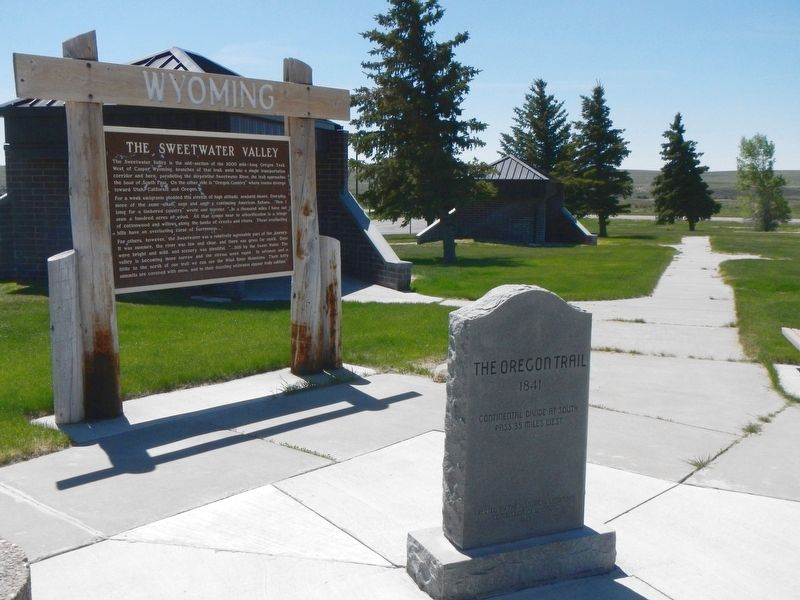
More about this marker. This marker is located at the Sweetwater Station rest area.
Also see . . . Sweetwater River (Wyoming) - Wikipedia. By 1843 the Sweetwater River valley was a regular wagon trail providing the water, grass and fuel needed on the Oregon, California and Mormon Trails across Wyoming. The Sweetwater provided an almost direct path from the Platte and North Platte Rivers to the wide South Pass Continental Divide between the Atlantic Ocean rivers and rivers that dumped in the Pacific Ocean.(Submitted on July 13, 2016, by Barry Swackhamer of Brentwood, California.)
Photographed by Barry Swackhamer, May 29, 2016
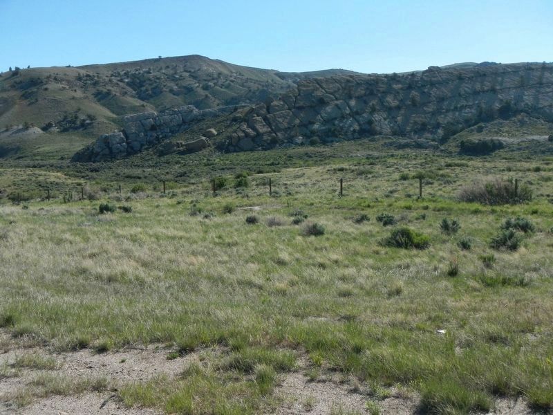
3. Split Rock Meadow, in the Sweetwater Valley
Credits. This page was last revised on July 13, 2016. It was originally submitted on July 13, 2016, by Barry Swackhamer of Brentwood, California. This page has been viewed 1,468 times since then and 59 times this year. Photos:1, 2, 3. submitted on July 13, 2016, by Barry Swackhamer of Brentwood, California.
