
Harrison in Sioux County, Nebraska — The American Midwest (Upper Plains)
Village of Harrison
Photographed by Dawn Bowen, July 26, 2008
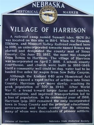
1. Village of Harrison Marker
Although the Kinkaid 640 acre Homestead Act of 1904 caused a rapid influx of settlers into Sioux County, Harrison grew more slowly, reaching its peak population of 500 in 1940. After World War II, a trend toward larger farms and ranches, mechanization, and improved transportation led to a loss of population. In its centennial year of 1986, Harrison (pop.360) remained the only incorporated town in Sioux County and the principal educational, governmental and trade center for its citizens, many of whom were descendants of pioneer settlers.
Erected by Nebraska State Historical Society;
this page online
Topics and series. This historical marker is listed in these topic lists: Agriculture • Settlements & Settlers. In addition, it is included in the Nebraska State Historical Society series list. A significant historical month for this entry is April 1924.
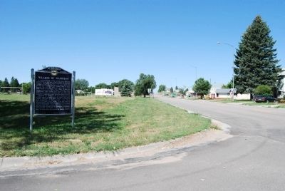
Location. 42° 41.471′ N, 103° 52.826′ W. Marker is in Harrison, Nebraska, in Sioux County. It is at the intersection of US 20 (U.S. 20 at milepost 9) and Kate Street, on the right when traveling east on US 20. Touch for map. Marker is in this post office area: Harrison NE 69346, United States of America. Touch for directions.

Regionally, this marker is in the Nebraska Panhandle. It is also in the American Midwest, in the Corn Belt, on the prairies, on the Great Plains, on the Northern Plains, and specifically on the High Plains. Globally, it is in North America, the Western Hemisphere, the Western World, and the Anglosphere. Historically, it finds itself in what was once the Louisiana Purchase.
Other nearby markers. At least one other marker is within 8 miles of this marker, measured as the crow flies: Coffee Siding (approx. 8
Photographed by Dawn Bowen, July 26, 2008
2. Village of Harrison Marker
Another marker is no longer nearby. Fort Laramie - Fort Robinson Trail (was approx. 7½ miles away but has been confirmed missing).
Credits. This page was last revised on June 16, 2016. It was originally submitted on July 27, 2008, by Dawn Bowen of Fredericksburg, Virginia. This page has been viewed 1,475 times since then and 11 times this year. Photos: 1, 2. submitted on July 27, 2008, by Dawn Bowen of Fredericksburg, Virginia. • Kevin W. was the editor who published this page.
