Weaubleau in Hickory County, Missouri — The American Midwest (Upper Plains)
John Whitaker
Aug. 15, 1842 • Jan. 6, 1910
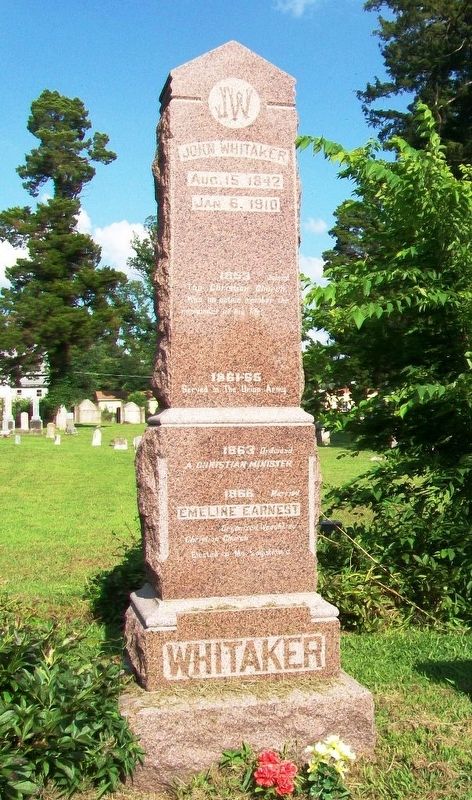
Photographed by William Fischer, Jr., July 10, 2016
1. John Whitaker Monument
Was an active member the remainder
of his life.
1861-1865 Served in The Union Army
1863 Ordained a Christian Minister
1866 Married Emeline Earnest
Organized Weaubleau Christian Church
Elected to Mo. Legislature
1871 Founded Weaubleau Christian Institute,
served 29 years as President.
1873 Graduated from Union Christian College,
honored the degrees of BS MSA MDO and LLD.
1904-08 Member of MO Legislature
1905 Organized the State Bank of Brownington, MO,
of which he remained President till his death.
1908 Republican nominee for Congress.
1909 Appointed Supervisor of the Census
by President Taft.
1910 Died Jan 6 at his home in Weaubleau, MO
He was true to himself, to his fellowmen and to his GOD.
Topics and series. This historical marker is listed in these topic lists: Cemeteries & Burial Sites • Education • Government & Politics • Religion & Religious Structures. In addition, it is included in the Former U.S. Presidents: #27 William Howard Taft series list. A significant historical date for this entry is August 15, 1842.
Location. 37° 53.492′ N, 93° 32.513′ W. Marker is in Weaubleau, Missouri, in Hickory County. It is on Main Street north of U.S. 54, on the right when traveling north. Touch for map. Marker is at or near this postal address: Weaubleau Congregational Christian Church, Weaubleau MO 65774, United States of America. Touch for directions.

Regionally, this marker is in South-Central Missouri. It is also in the American Ozarks, in the Lewis & Clark Corridor, and in the Corn Belt. Globally, it is in North America, the Western Hemisphere, the Western World, and the Anglosphere. Historically, it finds itself in what was once the territory of the Mississippian Culture, the Louisiana Purchase, and the Antebellum South.
Other nearby markers. At
this page online
Also see . . .
1. John Whitaker. Find A Grave website entry (Submitted on October 15, 2026, by Larry Gertner of New York, New York.)
2. Weaubleau Christian Church Catalog (1902). State Historical Society of Missouri PDF (Submitted on July 24, 2016, by William Fischer, Jr. of Reynoldsburg, Ohio.)
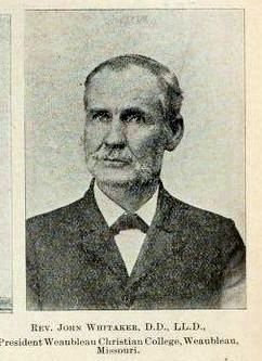
via Find A Grave, unknown
2. John Whitaker
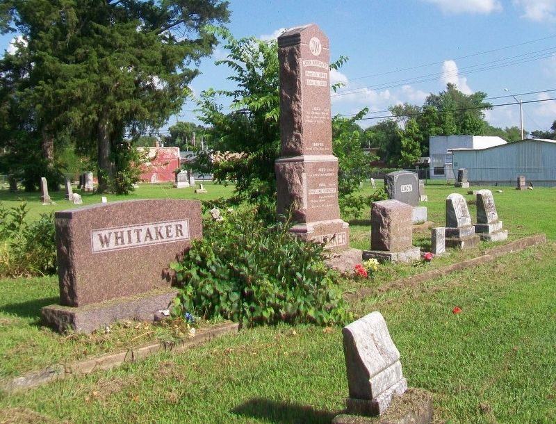
Photographed by William Fischer, Jr., July 10, 2016
3. John Whitaker Monument in Family Plot
Credits. This page was last revised on October 15, 2026. It was originally submitted on July 24, 2016, by William Fischer, Jr. of Reynoldsburg, Ohio. This page has been viewed 639 times since then and 41 times this year. Photos: 1. submitted on July 24, 2016, by William Fischer, Jr. of Reynoldsburg, Ohio. 2. submitted on October 15, 2026, by Larry Gertner of New York, New York. 3. submitted on July 24, 2016, by William Fischer, Jr. of Reynoldsburg, Ohio.
Editor’s want-list for this marker. Photo of the back of the monument • Can you help?
