Near Manteo in Dare County, North Carolina — The American South (South Atlantic)
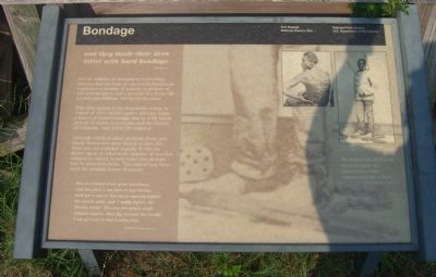
Bondage
and they made their lives
bitter with hard bondage
Exodus 1:14
For the millions of immigrants to this land, America has not been so much a destination as a promise: a promise of equality, a promise of self-determination and a promise of a better life for self and children. Not so for the slave.
With their arrival at the Jamestown colony in August of 1619, twenty captive Africans began a legacy of chattel bondage that by 1860 would include 15 states, 4 territories and the District of Columbia, with 3,952,760 enslaved.
Although mindless labor, physical abuse, and family destruction were typical of slave life, there was yet a greater tragedy. It was the slaves’ agony to witness the promise of America enjoyed by others, to help build that promise and be denied its fruits. This indeed may have been the greatest horror of slavery.
You are loosed from your moorings, and are free; I am fast to my chains and am a slave! You move merrily before the gentle gale, and I sadly before the bloody whip! You are freedom’s swift winged angels, that fly around the world; I am of iron! O that I were free!Frederick Douglass Narrative
The dark night of slavery closed in upon me; and behold a man transformed into a brute.Frederick Douglass Narrative
Erected by National Park Service, U.S. Department of the Interior.
Topics. This historical marker is listed in these topic lists: Abolition & Underground RR • African Americans • Notable Events. A significant historical year for this entry is 1619.
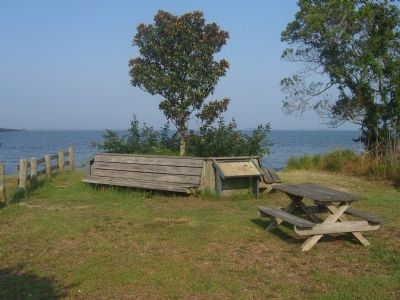
Location. Marker has been reported permanently removed. It was located near 35° 55.67′ N, 75° 43.418′ W. Marker was near Manteo, North Carolina, in Dare County. Marker was on Freedman's Colony Road near U.S. 64/264, on the right when traveling west. Marker is located at a pull-off on the right just before the William B. Umstead Memorial Bridge on the northern end of Roanoke Island. Touch for map. Marker was in this post office area: Manteo NC 27954, United States of America.
We have been informed that this sign or monument is no longer there and will not be replaced. This page is an archival view of what was.
Other nearby markers. At least 8 other markers are within one mile of this location, measured as the crow flies. Naval Battle of Roanoke Island (within shouting distance of this marker); Fort Huger (about 300 feet away, measured in a direct line); Fort Blanchard (approx. 0.2 miles away); First English Colonies (approx. ¼ mile away); R. A. Fessenden (approx. 0.3 miles away); Joachim Gans (approx. one mile away); A Civil War Refuge (approx. one mile away); A Legacy of Freedom (approx. one mile away). Touch for a list and map of all markers in Manteo.
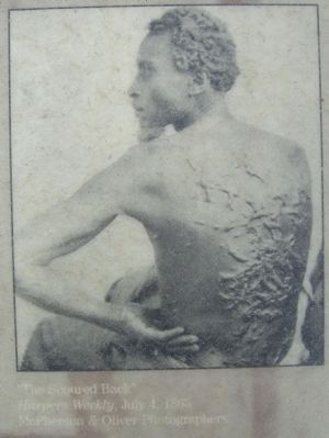
More about this marker. The first of the two pictures in the upper right of the marker is by McPherson & Oliver Photographers and titled, “The Second Back”. It was published in Harpers Weekly on July 4, 1863.
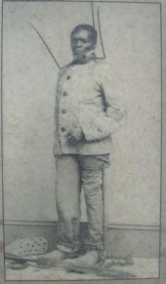
The second of the two pictures is of, "Wilson Chinn, a branded slave from Louisiana, exhibiting instruments of torture used to punish slaves."
The main picture is a closeup of the feet of Wilson Chinn, showing a ball and chain similar to what many slaves were forced to wear.
Credits. This page was last revised on January 27, 2022. It was originally submitted on July 29, 2008, by Kevin W. of Stafford, Virginia. This page has been viewed 2,280 times since then and 31 times this year. Photos: 1, 2, 3, 4. submitted on July 29, 2008, by Kevin W. of Stafford, Virginia.


