Big Piney in Sublette County, Wyoming — The American West (Mountains)
Building the Lander Trail
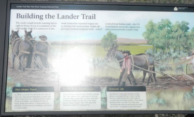
Photographed by Barry Swackhamer, June 2, 2016
1. Building the Lander Trail Marker
this page online
Erected by Sublette County Historical Society.
Topics. This historical marker is listed in this topic list: Roads & Vehicles.
Location. 42° 36.978′ N, 109° 51.162′ W. Marker is in Big Piney, Wyoming, in Sublette County. It is on Paradise Road near Wyoming 351 (Wyoming Highway 351). Touch for map. Marker is at or near this postal address: 1398 Paradise Road, Big Piney WY 83113, United States of America. Touch for directions.

Regionally, this marker is in Greater Yellowstone. It is also in the American Mountain West. Globally, it is in North America, the Rocky Mountains, the Western Hemisphere, the Western World, and the Anglosphere.
Other nearby markers. At least 8 other markers are within 10 miles of this marker, measured as the crow flies: "We Busy Ourselves in Various Ways" (about 500 feet away, measured in a direct line); The First Engines: Oxen, Mules, and Horses (about 500 feet away); "Hear Was Hundreds of Emigrants" (approx. 0.2 miles away); 19th Century Interstate Highway (approx. 0.2 miles away); Crossing the New Fork River (approx. ¼ mile away); Rising to the Challenge of the New Fork River (approx. ¼ mile away); New Fork River Crossing (approx. 0.3 miles away); Sand Springs - A Stop on the Oregon Trail (approx. 9.9 miles away). Touch for a list and map of all markers in Big Piney.
Also see . . . The Lander Trail: National Road Building Comes to Wyoming - Wyoming State Historical Society. Many believed that construction of the Lander Cutoff was intended to provide a route that avoided the Mormon settlements in Utah Territory. Following the ill-fated events at Mountain Meadows in September 1857, wherein California-bound emigrants of an Arkansas wagon train were murdered by Mormon militia, many travelers may have welcomed an alternate route.
However, many of the laborers Lander hired to build the new road were themselves Mormons from the Salt Lake Valley, making it seem unlikely the Army had any motives other than building a road that was safer because it was shorter. (Submitted on August 14, 2016, by Barry Swackhamer of Brentwood, California.)
Credits. This page was last revised on August 14, 2016. It was originally submitted on August 14, 2016, by Barry Swackhamer of Brentwood, California. This page has been viewed 566 times since then and 34 times this year. Photo 1. submitted on August 14, 2016, by Barry Swackhamer of Brentwood, California.
Editor’s want-list for this marker. An overview photo of the Building the Lander Trail maker showing the swale and setting of the marker. • Can you help?
