Oswego in Labette County, Kansas — The American Midwest (Upper Plains)
The Little Town Well
Photographed by William Fischer, Jr., August 14, 2016
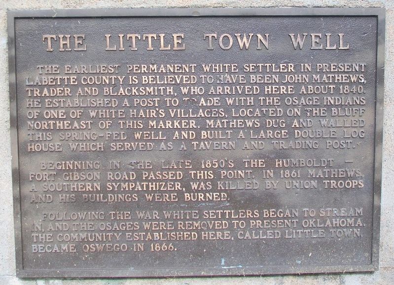
1. The Little Town Well Marker
The earliest permanent white settler in present Labette County is believed to have been John Mathews, trader and blacksmith, who arrived here about 1840. He established a post to trade with the Osage Indians of one of White Hair's villages, located on the bluff northeast of this marker. Mathews dug and walled this spring-fed well and built a large double log house which served as a tavern and trading post.
Beginning in the late 1850's the Humboldt-Fort Gibson Road passed this point. In 1861 Mathews, a Southern sympathizer, was killed by Union troops and his buildings were burned.
Following the war white settlers began to stream in, and the Osages were removed to present Oklahoma. The community established here, called Little Town, became Oswego in 1866.
Topics. This historical marker is listed in these topic lists: Charity & Public Work • Indigenous Peoples and Communities • Settlements & Settlers • War, US Civil. A significant historical year for this entry is 1840.
Location. 37° 10.021′ N, 95° 6.035′ W. Marker is in Oswego, Kansas, in Labette County. It is at the intersection of Union Street and 4th Street,
this page online

Regionally, this marker is in Eastern Kansas. It is also in the American Midwest, in the Corn Belt, on the prairies, and on the Southern Plains. Globally, it is in North America, the Western Hemisphere, the Western World, and the Anglosphere. Historically, it finds itself in what was once New Spain and also the Louisiana Purchase.
Other nearby markers. At least 8 other markers are within 9 miles of this marker, measured as the crow flies: John A. Mathews Park (here, next to this marker); Sulky Plow (approx. 0.4 miles away); Osage Indian Village (approx. 0.4 miles away); KATY Caboose Number 109 (approx. half a mile away); Riverside Park (approx. 0.6 miles away); Historic Riverside Park (approx. 0.6 miles away); Veterans Memorial Auditorium — Gymnasium (approx. 8.9 miles away); Parish of Sacred Heart - Chetopa (approx. 9 miles away). Touch for a list and map of all markers in Oswego.
Also see . . .
1. John Allen Mathews at Kansas Memory.
Photographed by William Fischer, Jr., August 14, 2016
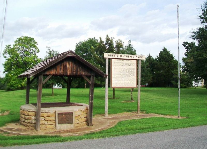
2. The Little Town Well and Marker
2. Allen County, Kansas in Community & Conflict. (Submitted on August 17, 2016, by William Fischer, Jr. of Reynoldsburg, Ohio.)
3. The Sacking and Burning of Humboldt, Kansas in Cutler's History of the State of Kansas. (Submitted on August 17, 2016, by William Fischer, Jr. of Reynoldsburg, Ohio.)
Credits. This page was last revised on September 4, 2020. It was originally submitted on August 17, 2016, by William Fischer, Jr. of Reynoldsburg, Ohio. This page has been viewed 749 times since then and 30 times this year. Photos: 1, 2. submitted on August 17, 2016, by William Fischer, Jr. of Reynoldsburg, Ohio.
