West Jefferson
The Historic National Road in Ohio
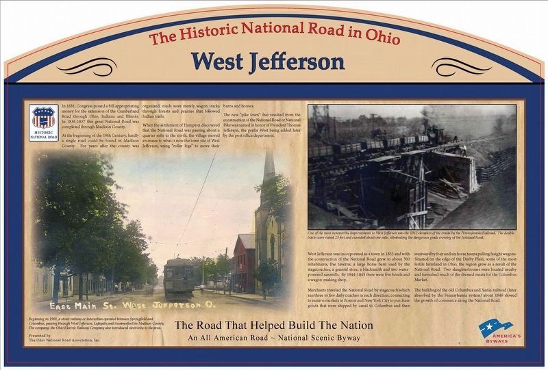
The new “pike town” that resulted from the construction of the National Road or National Pike was named in honor of President Thomas Jefferson, the prefix West being added by later by the post office department.
West Jefferson was incorporated as a town in 1833 and with the construction of the National Road grew to about 300 inhabitants, five tayerns, a large horse barn used by the stagecoaches, a grocery store, a blacksmith shop and two water
this page online
Merchants traveled the National Road by stagecoach which ran three to five daily coaches in each direction, connecting to eastern markets in Boston and New York City to purchase goods that were shipped by canal to Columbus and then westward by four and six horse teams pulling freight wagons. Situated on the Darby Plains, some of the most fertile farmland in Ohio, the region grew as a result of the National Road. Two slaughter houses were located nearby and furnished much of the dressed meats for the Columbus Market.
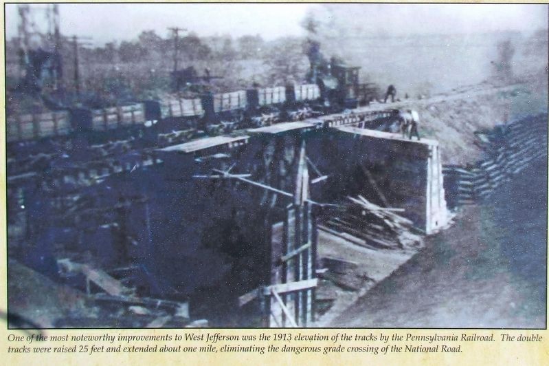
The building of the old Columbus and Xenia Railroad (later absorbed by the Pennsylvania system) about 1848 slowed the growth of commerce along the National Road.
Erected 2016 by The Ohio National Road Association, Inc.
Topics and series. This historical marker is listed in these topic lists: Railroads & Streetcars • Roads & Vehicles • Settlements & Settlers. In addition, it is included in the Former U.S. Presidents: #03 Thomas Jefferson, and the The Historic National Road series lists.
Location. 39° 56.699′ N,

Regionally, this marker is in the Columbus Metropolitan Area. It is also in the American Midwest and in the Corn Belt. Globally, it is in North America, the Western Hemisphere, the Western World, and the Anglosphere. Historically, it finds itself in what was once the Haudenosaunee (Iroquois) Confederacy, the territory of the Mississippian Culture, and the Northwest Territory.
Other nearby markers. At least 8 other markers are within 4 miles of this marker, measured as the crow flies: Welcome to West Jefferson (within shouting distance of this marker); New Hampton and Ludlow's Road (approx. 0.3 miles away); New Hampton Cemetery (approx. 0.3 miles away); V.F.W. Post 7005 Veterans Memorial (approx. 0.4 miles away); Jonathan Alder (approx. 3.4 miles away); The Glaciers Did It (approx.
Additional keywords. Old National Road
Credits. This page was last revised on August 23, 2016. It was originally submitted on August 18, 2016, by Rev. Ronald Irick of West Liberty, Ohio. This page has been viewed 1,459 times since then and 89 times this year. Photos: 1, 2, 3, 4, 5. submitted on August 18, 2016, by Rev. Ronald Irick of West Liberty, Ohio. • Bill Pfingsten was the editor who published this page.
