
Columbia in Maury County, Tennessee — The American South (East South Central)
Frierson Cemetery
Photographed by Judith Barber, February 6, 2013
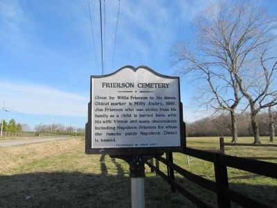
1. Frierson Cemetery Marker (side 1)
Given by Willis Frierson to his slaves. Oldest marker is Milly Embry, 1861. Jim Frierson who was stolen from his family as a child is buried here with his wife Vinnie and many descendents including Napoleon Frierson for whom the famous pacer Napoleon Direct is named.
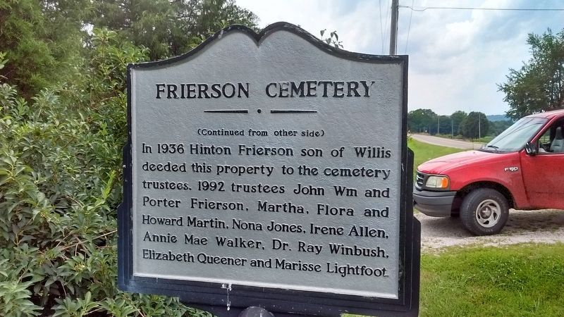
In 1936 Hinton Frierson son of Willis deeded this property to the cemetery trustees. 1992 trustees John Wm and Porter Frierson, Martha, Flora and Howard Martin, Nona Jones, Irene Allen, Annie Mae Walker, Dr. Ray Winbush, Elizabeth Queener and Marisse Lightfoot.
Topics. This historical marker is listed in these topic lists: African Americans • Cemeteries & Burial Sites. A significant historical year for this entry is 1861.
Location. 35° 37.057′ N, 87° 12.083′ W. Marker is in Columbia, Tennessee, in Maury County. It is on Hampshire Pike (U.S. 412) 0.4 miles east of North Cross Bridges Road, on the right when traveling east. Touch for map. Marker is at or near this postal address: 2893 Hampshire Pike, Columbia TN 38401, United States of America. Touch for directions.

Regionally, this marker is in Middle Tennessee and in Greater Nashville. It is also
this page online
Other nearby markers. At least 8 other markers are within 5 miles of this marker, measured as the crow flies: Jonathan Webster (approx. 1.3 miles away); Zion (approx. 3.4 miles away); Sam Watkins (approx. 3.4 miles away); Rattle and Snap Plantation (approx. 4.3 miles away); Delaying Forrest (approx. 4.6 miles away); St. John's (approx. 4.6 miles away); St. John's Episcopal Church (approx. 4.6 miles away); Forrest and Capron (approx. 4.6 miles away). Touch for a list and map of all markers in Columbia.
Photographed by Tom Bosse, July 3, 2016
2. Frierson Cemetery Marker (side 2)
Photographed by Judith Barber, February 6, 2013
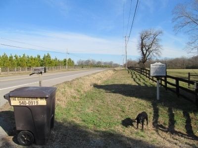
3. Frierson Cemetery Marker
Credits. This page was last revised on January 12, 2025. It was originally submitted on February 8, 2013, by Judith Barber of Marietta, Georgia. This page has been viewed 1,566 times since then and 71 times this year. Last updated on August 21, 2016, by Tom Bosse of Jefferson City, Tennessee. Photos: 1. submitted on February 8, 2013, by Judith Barber of Marietta, Georgia. 2. submitted on August 21, 2016, by Tom Bosse of Jefferson City, Tennessee. 3. submitted on February 8, 2013, by Judith Barber of Marietta, Georgia. • Bernard Fisher was the editor who published this page.
