Thoroughfare in Prince William County, Virginia — The American South (Mid-Atlantic)
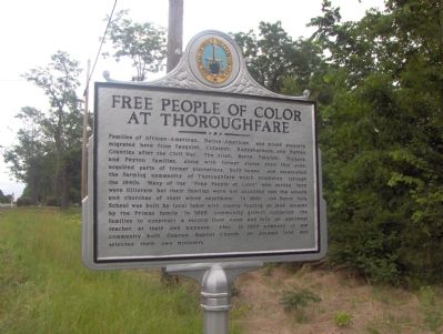
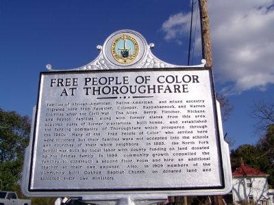
Free People Of Color At Thoroughfare
Erected 2004 by Prince William County Historical Commission. (Marker Number 68.)
Topics and series. This historical marker is listed in these topic lists: African Americans • Churches & Religion • Civil Rights • Settlements & Settlers. In addition, it is included in the Virginia, Prince William County Historical Commission series list. A significant historical year for this entry is 1885.
Location. 38° 49.233′ N, 77° 40.598′ W. Marker is in Thoroughfare, Virginia, in Prince William County. Marker is on John Marshall Highway (Virginia Route 55) west of Thoroughfare Road, on the left when traveling west. It is just a few steps from the east side of the railroad crossing on John Marshall Hwy (SR 55). TerraServer shows the lat-long as 38.82174, -77.67458. Touch for map. Marker is in this post office area: Broad Run VA 20137, United States of America. Touch for directions.
Other nearby markers. At least 5 other markers are within walking distance of this marker. The Battle of Thoroughfare Gap & Chapman's Mill (approx. ¼ mile away); The Thoroughfare Colored / North Fork School (approx. ¼ mile away); Water Fowl And Their Habitat (approx. ¼ mile away); Antioch-McCrae African American School (approx. 0.3 miles away); Farm Life (approx. half a mile away).
Additional commentary.
1. Additional Prominent Family
I am descendant of Joseph Milton Barbour whom married Elizabeth Hall. They are kin to the Berry's and Nickens. They also owned a very large
farm in close promixity to the Berry's and Nickens. Joseph and his wife are buried on that land today.
— Submitted January 2, 2009, by Sheila Ann Joy of Washington, District of Columbia.
2. Location of North Fork School mentioned on marker
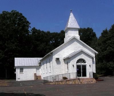
Under photo 4, Paul Crumlish says: "It is unclear from county records where the other building mentioned on the marker, North Fork School, is located." The school was on the hill, directly west of the tracks from the marker's location. Note To Editor only visible by Contributor and editor
— Submitted December 6, 2009, by Pat Fletcher of Tacoma, Washington.
Photographed By Paul Crumlish, August 18, 2009
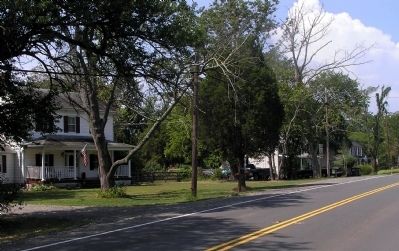
3. The community of Thoroughfare today
This is the largest grouping of houses in Thoroughfare. These are adjacent to the historical marker on the south side of road. The marker is just beyond the distant house. Most of the structures on the north side are gone due to the construction of I-66 closely paralleling SR-55.
Photographed By Paul Crumlish, August 24, 2009
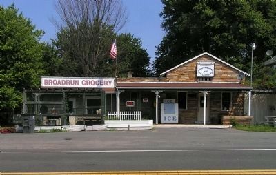
5. The last vestiges of Thoroughfare commerce
Located on SR-55, directly across the road from the historical marker, is this store. Originally opened as Chambers' Grocery in the mid 1910s, it continues to serve the diminishing population of Thoroughfare.
Photographed By Paul Crumlish, August 24, 2009
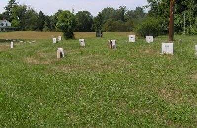
6. Allen-Fletcher Family Cemetery
Burial place for several of Thoroughfare's founding families and early leaders, including Frank Fletcher, who built many of the community's early buildings. Frank Fletcher was free-born in Rappahannock County in 1833. His free-born papers were issued when he left that county for work in Warren County in 1855.
Credits. This page was last revised on June 16, 2016. It was originally submitted on October 6, 2006, by Roger Dean Meyer of Yankton, South Dakota. This page has been viewed 7,274 times since then and 99 times this year. Last updated on April 24, 2007. Photos: 1. submitted on October 6, 2006, by Roger Dean Meyer of Yankton, South Dakota. 2. submitted on April 24, 2007, by Pat Fletcher of Tacoma, Washington. 3, 4. submitted on August 18, 2009, by PaulwC3 of Northern, Virginia. 5, 6. submitted on August 26, 2009, by PaulwC3 of Northern, Virginia. • J. J. Prats was the editor who published this page.
