Near Trinidad in Las Animas County, Colorado — The American Mountains (Southwest)
Road to Santa Fe
⎯⎯⎯
Over the Pass
⎯⎯⎯
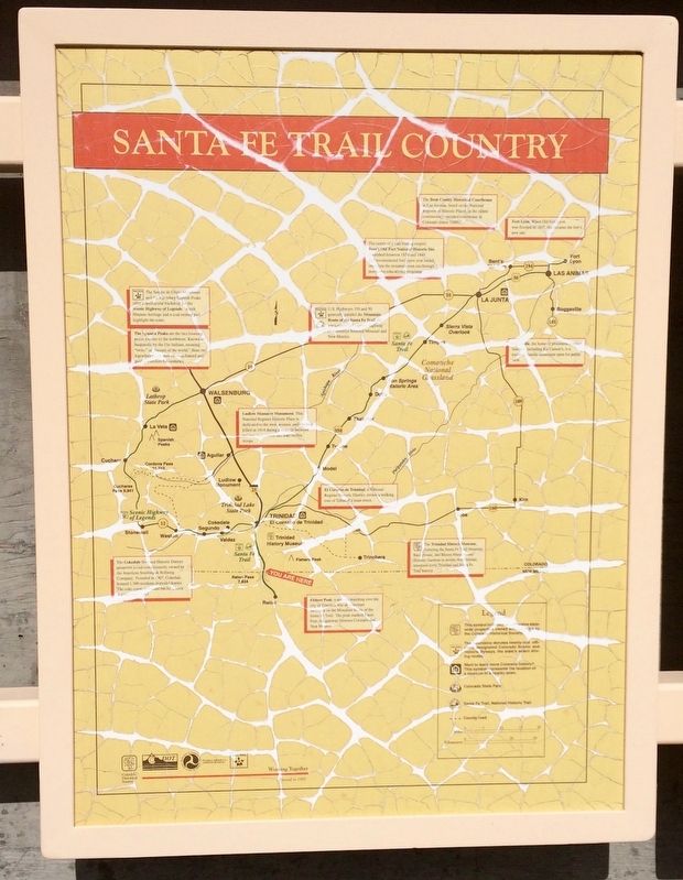
Santa Fe Trail Country
⎯⎯⎯
"Uncle Dick" Wootton
Photographed by Mark Hilton, July 22, 2016
1. Raton Pass (Panel 1)
Panel 1
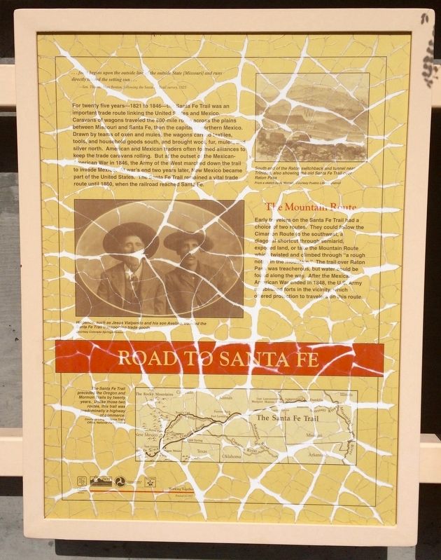
The Mountain Route
Early travelers on the Santa Fe Trail had a choice of two routes. They could follow the Cimarron Route to the southwest,
this page online
Also found on this panel:
Map
(Caption) The Santa Fe Trail preceded the Oregon and Mormon Trails by twenty years. Unlike those two routes, this trail was predominantly a highway of commerce.
Courtesy Long Distance Trails Office, National Park Service
Photo of two men
(Caption) Hispanos, such as Jesus Vialpando and his son Avelino, traveled the Santa Fe Trail transporting trade goods.
Courtesy Colorado Springs Museum
Drawing of trail near Raton Pass
(Caption) South end of the Raton switchback and tunnel near Trinidad, also showing the old Santa Fe Trail over Raton Pass
From a sketch by H. Worrall, courtesy Public Library District
Panel 2
Photographed by Mark Hilton, July 22, 2016
2. Raton Pass (Panel 2)
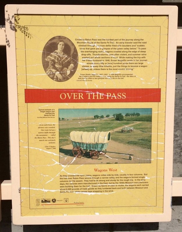
Wagons West
As they crossed the open plains, wagons rolled side by side, usually in four columns. But the trail over Raton Pass wound through a narrow valley, and the wagons formed single columns for the ascent. They had to be strong and sturdy for the rough trip. In the early days, the vehicles were manufactured in the East, but by the 1840s Missouri manufacturers were building them for the trail. Drawn by teams of oxen or mules, the wagons each carried about 6,000 pounds of trade goods as they lumbered back and forth between Missouri
Photographed by Mark Hilton, July 22, 2016
3. Raton Pass (Panel 3)
"...at an early hour, the advance was sounded. Our route led up a narrow defile through the mountains...called the Raton Pass. This day's march was extremely arduous." - John T. Hughes, August 7, 1846.
Also found on this panel:
Photo of a restored covered wagon
(Caption) Typical example of a freight wagon that traveled the Santa Fe Trail
Courtesy National Park Service
Photo of Susan Magoffin
(Caption) Susan Shelby Magoffin, 1827-1855. In 1846 Magoffin accompanied her husband and his trade caravan along the Santa Fe Trail. Her diary of that journey offers a rare glimpse into daily life on the trial. Colorado Historical Society
Panel 3
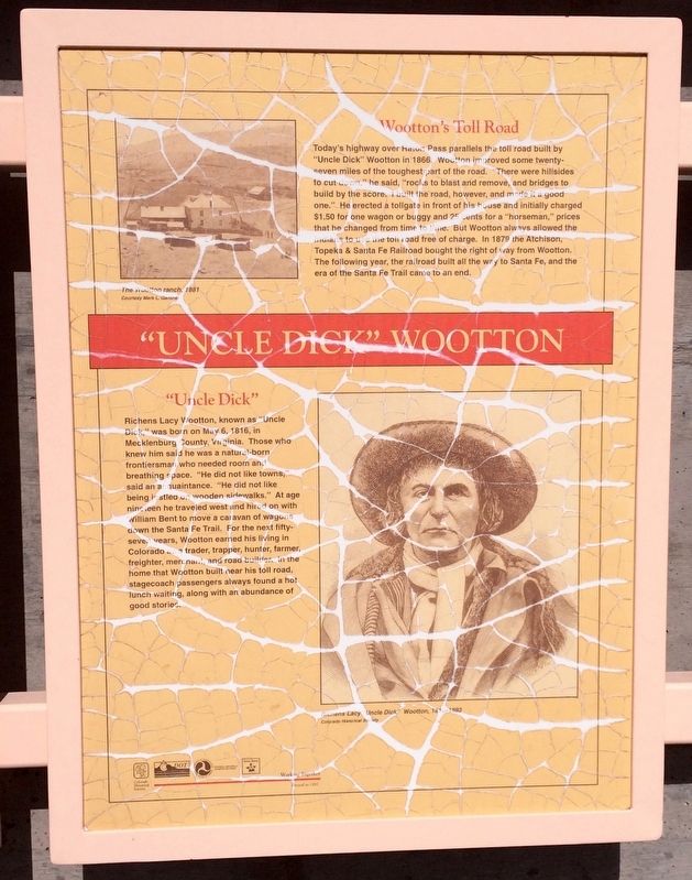
Today's highway over Raton Pass parallels the toll road built by "Uncle Dick" Wootton in 1866. Wootton improved some twenty-seven miles of the toughest part of the road. "There were hillsides to cut down," he said, "rocks to blast and remove, and bridges to build by the score. I built the road, however, and made it a good one." He erected
Photographed by Mark Hilton, July 22, 2016
4. Raton Pass (Panel 4)
"Uncle Dick"
Richens Lacy Wootton, known as "Uncle Dick," was born on May 6, 1916, in Mecklenburg County, Virginia. Those who knew him said he was a natural-born frontiersman who needed room and breathing space. "He did not like towns said an acquaintance. "He did not like being jostled on wooden sidewalks." At age nineteen he traveled west and hired on with William Bent to move a caravan of wagons down the Santa Fe Trail. For the next fifty-seven years, Wootton earned his living in Colorado as a trader, trapper, hunter, farmer, freighter, merchant, and road builder. In the home that Wootton built near his toll road, stagecoach passengers always found a hot lunch waiting, along with an abundance of good
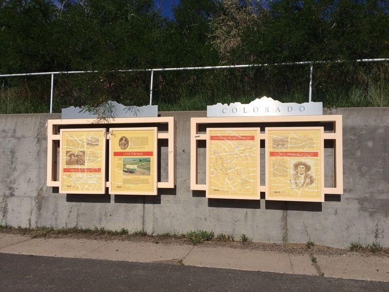
Photographed by Mark Hilton, July 22, 2016
5. Raton Pass Marker at Colorado/New Mexico border on I-25.
Also found on this panel:
Photo of Richard Lacy "Uncle Dick" Wootton, 1816-1893
Colorado Historical Society
Photo of the Wootton ranch, 1881
Colorado Historical Society
Erected 1997 by Colorado Historical Society. (Marker Number 212.)
Topics and series. This historical marker is listed in these topic lists: Exploration • Roads & Vehicles • Settlements & Settlers. In addition, it is included in the History Colorado, and the Santa Fe Trail series lists. A significant historical date for this entry is May 6, 1916.
Location. 36° 59.633′ N, 104° 28.794′ W. Marker is near Trinidad, Colorado, in Las Animas County. It can be reached from Interstate 25 Frontage Road when traveling north. Marker is located some 13 miles south of Trinidad Colorado at the Colorado/New Mexico border and the Colorado Department of Transportation (CDOT) pull-off on I-25. Take I-25 northbound exit 460 some 0.7 miles, staying to the left into the pull-off. Touch for map. Marker is in this post office area: Trinidad CO 81082, United States of America. Touch for directions.

Regionally, this marker is in the American Mountain West, on the
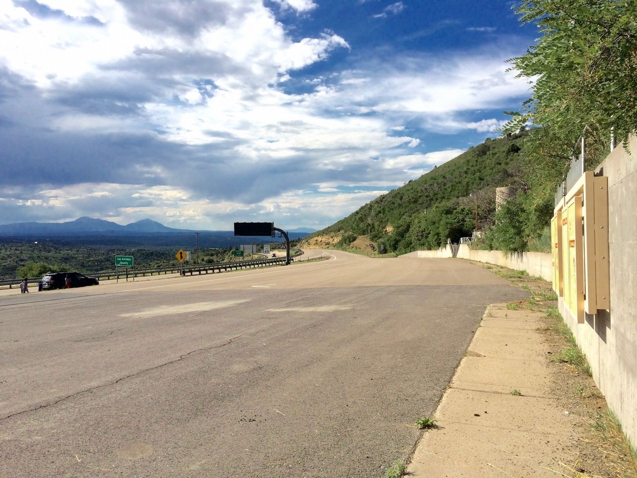
Photographed by Mark Hilton, July 22, 2016
6. View from marker towards entrance ramp back onto I-25 in Colorado.
Other nearby markers. At least 8 other markers are within 13 miles of this marker, measured as the crow flies: Raton Pass (within shouting distance of this marker); Trinidad: A Place to Explore and Discover… Create and Recreate..... Innovate and Invent (approx. 0.9 miles away); Palace Hotel (approx. 6.8 miles away in New Mexico); The Mountain Route (approx. 7.8 miles away in New Mexico); First Automobile in New Mexico (approx. 7.8 miles away in New Mexico); Raton (approx. 8.2 miles away in New Mexico); Temple Aaron 1889 (approx. 12 miles away); A Clash of Cultures (approx. 12.1 miles away). Touch for a list and map of all markers in Trinidad.
More about this marker. Due to weathering and sun damage the marker has suffered crazing.
Related marker. Click here for another marker that is related to this marker.
Also see . . . Wikipedia article on the Raton Pass. (Submitted on September 12, 2016, by Mark Hilton of Montgomery, Alabama.)
Credits. This page was last revised on December 10, 2024. It was originally submitted on September 12, 2016, by Mark Hilton of Montgomery, Alabama. This page has been viewed 1,851 times since then and 80 times this year. Photos: 1, 2, 3, 4, 5, 6. submitted on September 12, 2016, by Mark Hilton of Montgomery, Alabama.
