Glasgow near Newark in New Castle County, Delaware — The American Northeast (Mid-Atlantic)
Washington's Reconnaissance
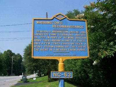
Photographed by William Pfingsten, July 29, 2008
1. Washington's Reconnaissance Marker
Erected 1932 by Historic Markers Commission. (Marker Number NC-53.)
Topics and series. This historical marker is listed in these topic lists: War, US Revolutionary • Waterways & Vessels. In addition, it is included in the Delaware Public Archives, and the Former U.S. Presidents: #01 George Washington series lists. A significant historical year for this entry is 1777.
Location. 39° 37.996′ N, 75° 44.983′ W. Marker is near Newark, Delaware, in New Castle County. It is in Glasgow. It is on South Old Baltimore Pike, on the right when traveling west. Touch for map. Marker is at or near this postal address: 1249 S Old Baltimore Pike, Newark DE 19702, United States of America. Touch for directions.

Regionally, this marker is in Greater Wilmington and in Greater Philadelphia. It is also in the American Mid-Atlantic, on the Delmarva Peninsula, and on the Eastern Seaboard. Globally,
this page online
Other nearby markers. At least 8 other markers are within walking distance of this marker: Iron Hill (approx. 0.3 miles away); Historic Roads of Newark, Delaware / Petrified Log from Central Delaware (approx. half a mile away); Education for ALL, Past and Present: Iron Hill School, No. 112C / Iron Hill School #112C (approx. half a mile away); Iron Hill School #112-C (approx. half a mile away); Iron Mining on Iron and Chestnut Hills, A Timeline (approx. half a mile away); The Civil War 1861 - 1865 (approx. half a mile away); What is the mound behind this sign? (approx. half a mile away); The Iron Hill Community: Free Black Landowners (approx. half a mile away). Touch for a list and map of all markers in Newark.
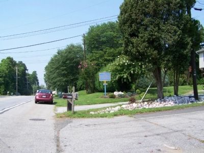
Photographed by William Pfingsten, July 29, 2008
2. Washington's Reconnaissance Marker
Credits. This page was last revised on December 31, 2023. It was originally submitted on August 1, 2008, by Bill Pfingsten of Bel Air, Maryland. This page has been viewed 2,329 times since then and 39 times this year. Photos: 1, 2. submitted on August 1, 2008, by Bill Pfingsten of Bel Air, Maryland.
