Marker Logo HMdb.org THE HISTORICAL
MARKER DATABASE
“Bite-Size Bits of Local, National, and Global History”
Corbin in Whitley County, Kentucky — The American South (East South Central)
 

Kiwanis Trail


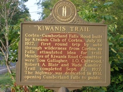
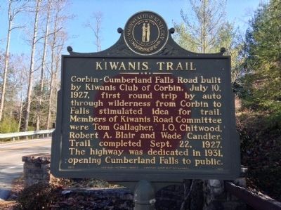
Kiwanis Trail Marker image. Click for full size.
Photographed By Christopher Light, June 21, 2008
1. Kiwanis Trail Marker
Inscription. Corbin-Cumberland Falls Road built by Kiwanis Club of Corbin. July 10, 1927, first round trip by auto through wilderness from Corbin to Falls stimulated idea for trail. Members of Kiwanis Road Committee were Tom Gallagher, I.O. Chitwood, Robert A. Blair ad Wad Candler. Trail completed Sept. 22, 1927. The highway was dedicated in 1931, opening Cumberland Falls to public.
 
Erected 1975 by Kentucky Historical Society & Kentucky Department of Highways. (Marker Number 1517.)
 
Topics and series. This historical marker is listed in this topic list: Roads & Vehicles. In addition, it is included in the Kentucky Historical Society series list. A significant historical date for this entry is July 10, 1933.
 
Location. 36° 50.413′ N, 84° 20.371′ W. Marker is in Corbin, Kentucky, in Whitley County. Marker is at the intersection of Kentucky Route 90, on the right when traveling south on State Route 90. Located at the entrance to Cumberland Falls Lodge. Touch for map. Marker is at or near this postal address: 7351 Highway 90, Corbin KY 40701, United States of America. Touch for directions.
 
Other nearby markers. At least 8 other markers are within 12 miles of this marker, measured as the crow flies. CCC at Cumberland Falls / Civilian Conservation Corps (a few steps from this marker); Cumberland Falls MoonBow (approx. ¼ mile away); 4-H Craft Center
Paid Advertisement
Click on the ad for more information.
Please report objectionable advertising to the Editor.
Click or scan to see
this page online
(approx. 3.1 miles away); McCreary County, 1912 (approx. 10.7 miles away); First Kentucky Oil Well / Martin Beaty (Beatty) (approx. 10.7 miles away); Bon Jellico (approx. 11½ miles away); First White Men Here (approx. 11.6 miles away); "Aunt Julia" Marcum (approx. 12 miles away).
 
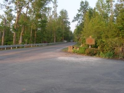
Up-Date Photo - - Kiwanis Trail Marker image. Click for full size.
Photographed By Michael Frazier, November 21, 2013
2. Up-Date Photo - - Kiwanis Trail Marker
Kiwanis Trail Marker image. Click for full size.
Photographed By Christopher Light, June 21, 2008
3. Kiwanis Trail Marker
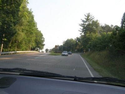
Kiwanis Trail (east end) image. Click for full size.
Photographed By Christopher Light, June 21, 2008
4. Kiwanis Trail (east end)
State Route 90 (Kiwanis Trail) begins near Young Creek on US 25 west.
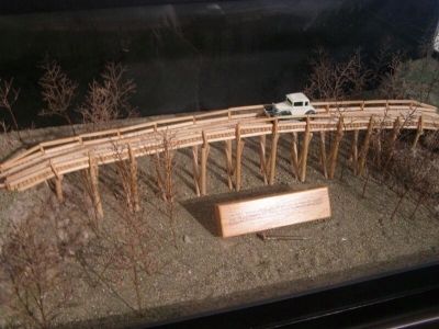
diorama of the Old Pole Bridge on the Kiwanis Road. image. Click for full size.
Photographed By Christopher Light, June 22, 2008
5. diorama of the Old Pole Bridge on the Kiwanis Road.
Gold Spike - on September 22, 1927, this gold spike was driven into a trestle of the Old Pole Bridge by Gov. William Jason ???, officially opening the Kiwanis Road from Corbin to Cumberland Falls.
 
 
Credits. This page was last revised on June 16, 2016. It was originally submitted on August 2, 2008, by Christopher Light of Valparaiso, Indiana. This page has been viewed 1,652 times since then and 34 times this year. Photos:   1. submitted on August 2, 2008, by Christopher Light of Valparaiso, Indiana.   2. submitted on December 20, 2013, by Michael Frazier of Fort Myers, Florida.   3, 4, 5. submitted on August 2, 2008, by Christopher Light of Valparaiso, Indiana. • Craig Swain was the editor who published this page.
Share this page.  
Share on Tumblr
m=9813

CeraNet Cloud Computing sponsors the Historical Marker Database.
This website earns income from purchases you make after using our links to Amazon.com. We appreciate your support.
Paid Advertisement
Apr. 23, 2024