Frankfort in Franklin County, Kentucky — The American South (East South Central)
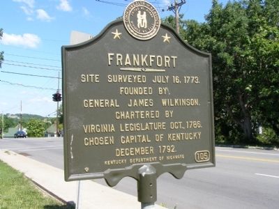
Frankfort
Founded by
General James Wilkinson.
Chartered by
Virginia Legislature Oct., 1786.
Chosen Capital of Kentucky
December 1792
Erected by Kentucky Department of Highways. (Marker Number 105.)
Topics and series. This historical marker is listed in these topic lists: Colonial Era • Settlements & Settlers. In addition, it is included in the Kentucky Historical Society series list. A significant historical date for this entry is July 16, 1773.
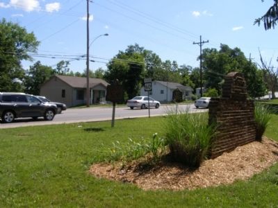
Location. 38° 11.885′ N, 84° 51.947′ W. Marker is in Frankfort, Kentucky, in Franklin County. Marker is at the intersection of East Main Street (U.S. 60) and Glenns Creek Road, on the right when traveling west on East Main Street. Touch for map. Marker is in this post office area: Frankfort KY 40601, United States of America. Touch for directions.
Other nearby markers. At least 8 other markers are within walking distance of this marker. Daniel Boone - Pioneer / Grave of Daniel Boone (a few steps from this marker); Frankfort Cemetery (about 400 feet away, measured in a direct line); Governor William Gobel (approx. 0.2 miles away); Our Confederate Dead (approx. ¼ mile away); The Trabue Family Vault (approx. ¼ mile away); Kentucky's State Mound (approx. 0.3 miles away); Lt. Presley N. O'Bannon, USMC (approx. 0.3 miles away); Daniel Boone's Grave (approx. 0.3 miles away). Touch for a list and map of all markers in Frankfort.
Credits. This page was last revised on November 20, 2019. It was originally submitted on August 2, 2008, by Christopher Light of Valparaiso, Indiana. This page has been viewed 1,336 times since then and 43 times this year. Photos: 1, 2. submitted on August 2, 2008, by Christopher Light of Valparaiso, Indiana. • Craig Swain was the editor who published this page.

