Riverside in Buffalo in Erie County, New York — The American Northeast (Mid-Atlantic)
Niagara River Corridor / Avian Walk
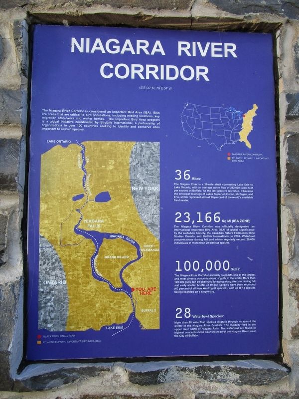
[left panel] Niagara River Corridor, 43°E 07'N, 79°E 04W
The Niagara River Corridor is considered an Important Bird Area (IBA). IBAs are areas that are critical to bird populations, including nesting locations, key migration stop-overs and winter homes. The Important Bird Area in a global initiative coordinated by BirdLife International, a partnership of organizations in over 100 countries seeking to identify and conserve sites important to all bird species.
36 Miles: The Niagara River is a 36-mile strait connecting Lake Erie to Lake Ontario, with an average water flow of 212,000 cubic feet per second at Buffalo. As the last glaciers retreated, it became the principal drainage of Lakes Superior, Huron, Michigan, and Erie, which represent almost 20 percent of the world's available fresh water.
23,166 Sq Mi (IBA Zone): The Niagara River Corridor was officially designated an International Important Bird Area (IBA) of global significance by the Audubon Society, the Canadian Nature Federation, Bird Studies Canada, and BirdLife International in 2002. Waterfowl concentrations during fall and winter regularly exceed 20,000 individuals of more than 20 distinct species.
100,000 Gulls: The Niagara River Corridor annually supports one of the largest and most diverse concentrations of gulls in the world. More than 100,000 gulls can be observed foraging along the river during fall and early winter. A total of 19 gull species have been recorded (60 percent of all New World gull species), with up to 14 species being recorded on a single day.
28 Waterfowl Species: More than 28 waterfowl species migrate through or spend the winter in the Niagara River Corridor. The majority feed in the upper river north of Niagara Falls. The waterfowl are found in highest concentrations near the head of the Niagara River, near the City of Buffalo.
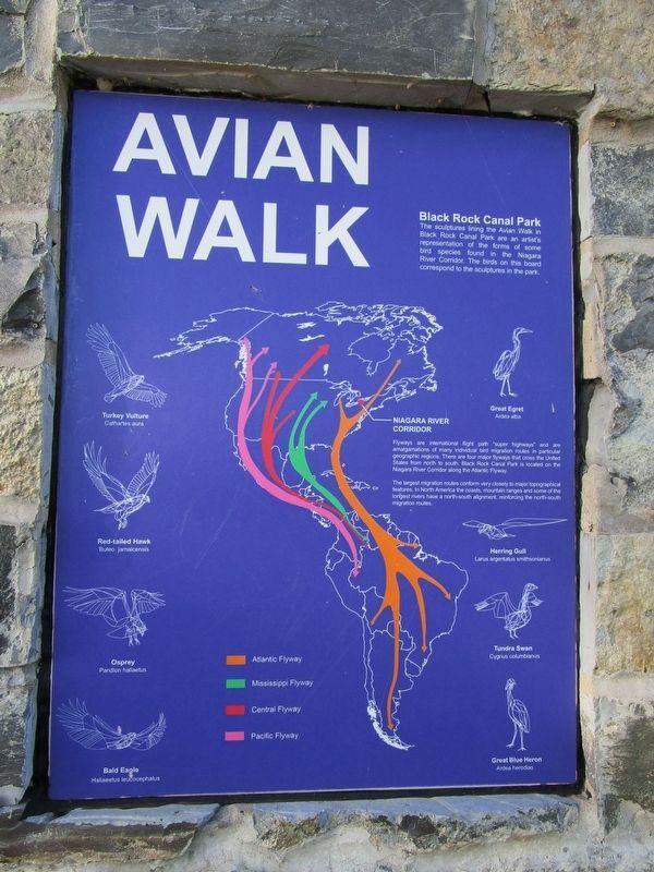
[right panel] Avian Walk
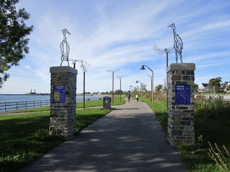
Black Rock Canal Park. The sculptures lining the Avian Walk in Black Rock Canal Park are an artist's representation of the forms of some bird species found in the Niagara River Corridor. The birds on this board correspond to the sculptures in the park.
Turkey Vulture, Cathartes aura; Great Egret, Ardea alba; Red-tailed Hawk, Buteo jamaicensis; Herring Gull, Larus argentatus smithsonianus; Osprey, Pandion haliaetus; Tundra Swan, Cygnus columbianus; Bald Eagle, Haliaeetus leucocphalus; Great Blue Heron, Ardea herodias.
Niagara River Corridor. Flyways are international flight path "super highways" and are amalgamations of many individual bird migrations routes in particular geographic regions. There are four major flyways that cross the United States from north to south. Black Rock Canal Park is located on the Niagara River Corridor along the Atlantic Flyway.
The largest migration routs conform very closely to major topographical features. In North America the coasts, mountain ranges and some of the longest rivers have a north-south alignment, reinforcing the north-south migration routes.
[orange] Atlantic Flyway. [green] Mississippi Flyway. {red] Central Flyway. [pink] Pacific Flyway.
Topics. This historical marker is listed in these topic lists: Animals • Arts, Letters, Music • Waterways & Vessels. A significant historical year for this entry is 2002.
Location. 42° 56.813′ N, 78° 54.557′ W. Marker is in Buffalo, New York, in Erie County. It is in Riverside. Marker is on Aqua Lane, 0.1 miles Black Rock Harbor, in the median. Marker is in Black Rock Canal Park. Access to the park is from Niagara Street (NY route 266) just south of the entrance to Interstate 190 North. Touch for map. Marker is in this post office area: Buffalo NY 14207, United States of America. Touch for directions.
Other nearby markers. At least 8 other markers are within walking distance of this marker. Hunting and Fishing off the Porch (about 400 feet away, measured in a direct line); The Niagara River (about 500 feet away); Tow Path Park (approx. half a mile away); The Fenian Invasion of 1866 (approx. half a mile away); Bernard G. Hitro Jr. (approx. half a mile away); In Memory of the Sons and Daughters
(approx. 0.6 miles away); Park with a View (approx. 0.6 miles away); Erected by the Grateful People (approx. 0.6 miles away). Touch for a list and map of all markers in Buffalo.
Credits. This page was last revised on February 16, 2023. It was originally submitted on September 26, 2016, by Anton Schwarzmueller of Wilson, New York. This page has been viewed 399 times since then and 29 times this year. Photos: 1, 2, 3. submitted on September 26, 2016, by Anton Schwarzmueller of Wilson, New York.


