Near Lusk in Niobrara County, Wyoming — The American West (Mountains)
Along the Cheyenne to Deadwood Stage: Hat Creek Stage Station
Photographed by Barry Swackhamer, June 7, 2016
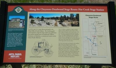
1. Along the Cheyenne to Deadwood Stage: Hat Creek Stage Station Marker
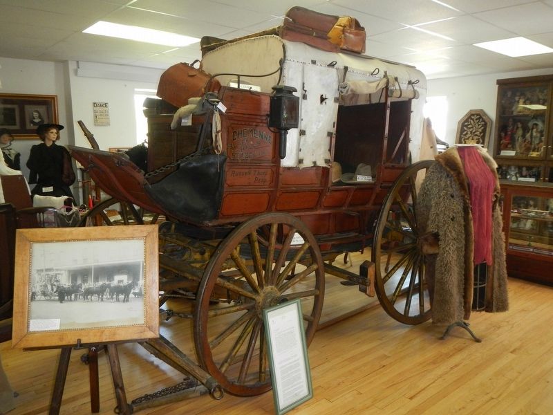
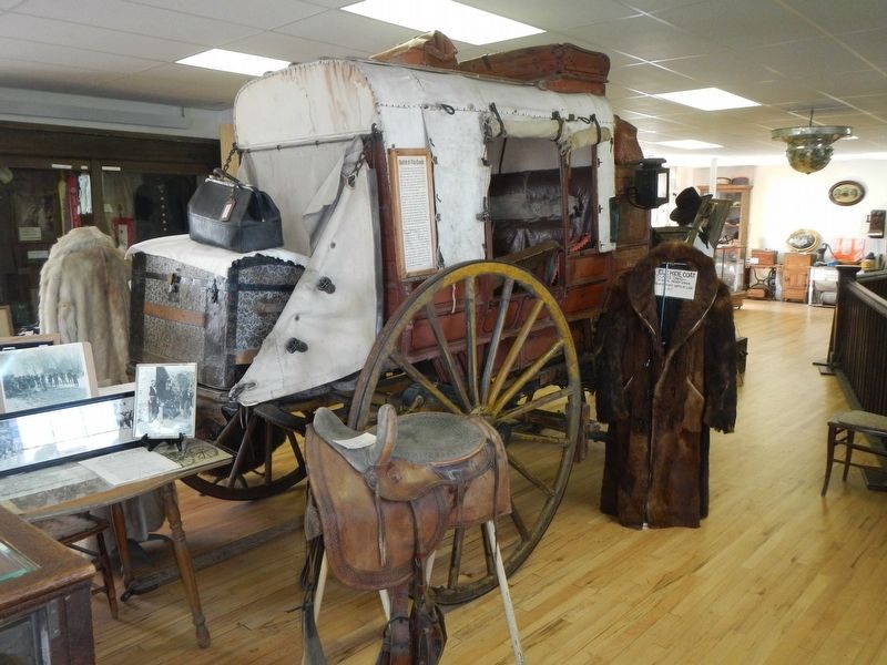
Captions: (top center) Stagecoaches following the Cheyenne-Deadwood Stage Route left wheel ruts in the soft sedimentary rock of this region. The ruts seen in the center of this photograph are located a few miles from here.; (bottom center) The Stagecoach Museum in Lusk displays the only survivor of 30 coaches used on the Cheyenne-Deadwood Stage Route.; (map on right) The Cheyenne-Deadwood Stage Route ran approximately 300 miles along the western border of Wyoming Territory between 1876 and 1887.; (sidebar on left) The Hat Creek Stage Station is the last station standing on the Cheyenne-Deadwood Stage Route. In 1927, the Daughters of the American Revolution erected a monument to the memory of those who operated the stage line and traveled the route.
In 1874, the U.S. Army discovered gold in the Black Hills of South Dakota. The resulting gold rush required a stage line that could carry gold from the remote mining town of Deadwood, Dakota Territory, to Cheyenne, a commercial center on the Union Pacific Railroad.
The U.S. Military established a single-company infantry post called Fort Hat Creek in 1875. Three stage stations have stood near the post. The first was built in 1876 but burned later the same year. A long log building that housed a telegraph station, post office, blacksmith shop, road house, stages and store replaced the first station after it burned. In the early 1880s. the two-story, hip-roof stage station that stands today was erected and the second stage station was torn down.
The Hat Creek station was located at the southern edge of the most dangerous section of the Cheyenne-Deadwood Stage Route. Near the station, travelers frequently encountered Indians defending the Black Hills territory and road agents robbing the stagecoaches. In February of 1887 the last stagecoach pulled through the Hat Creek station as the Chicago and Northwestern Railroad
this page online
[Side bar:]
Hat Creek Stage Station is actually located on Sage Creek. Tradition states that a troop of soldiers from Fort Laramie intended to locate a military outpost on Hat Creek in western Nebraska. Mistaking Sage Creek for Hat Creek, the soldiers established a post and gave it the name of their intended destination. The name stuck and was given to the stage station as well.
Erected by Wyoming State Parks & Cultural Resources.
Topics. This historical marker is listed in these topic lists: Industry & Commerce • Roads & Vehicles.
Location. 42° 56.34′ N, 104° 22.182′ W. Marker is near Lusk, Wyoming, in Niobrara County. It is on CanAm Highway (U.S. 85 at milepost 163) near Hat Creek Road, on the left when traveling south. Touch for map. Marker is in this post office area: Lusk WY 82225, United States of America. Touch for directions.

Regionally, this marker is in Wyoming’s Laramie Basin. It is also in the American Mountain West, on
Photographed by Barry Swackhamer, June 7, 2016
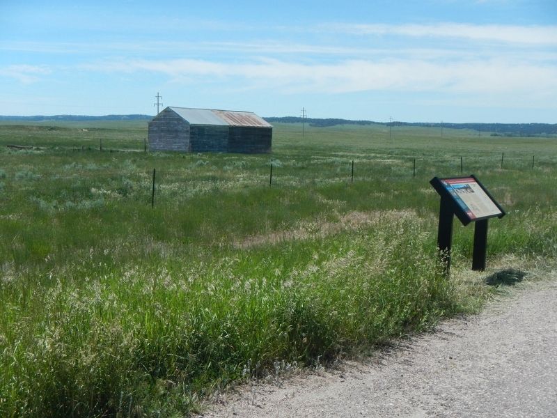
2. Along the Cheyenne to Deadwood Stage: Hat Creek Stage Station Marker
The building in the background is not the Hat Creek Stage Station.
Other nearby markers. At least 8 other markers are within 14 miles of this marker, measured as the crow flies: Hat Creek Stage Station (approx. 1½ miles away); Redwood Water Tank (approx. 12.8 miles away); a different marker also named Redwood Water Tank (approx. 12.8 miles away); Wyoming National Guard Armory (approx. 13 miles away); The Iron Clad Store (approx. 13 miles away); The Lusk House (approx. 13 miles away); Niobrara County Courthouse (approx. 13 miles away); Monuments to Wyoming History (approx. 13.3 miles away). Touch for a list and map of all markers in Lusk.
Another marker is no longer nearby. Oldest Building in Lusk (was approx. 13 miles away but has been replaced with another marker now near it).
More about this marker. This marker is approximately 13 miles north of Lusk.
Photographed by Barry Swackhamer, June 8, 2016
3. The only survivor of 30 coaches used on the Cheyenne-Deadwood Stage Route
Photographed by Barry Swackhamer, June 8, 2016
4. The only survivor of 30 coaches used on the Cheyenne-Deadwood Stage Route
Located at the Stagecoach Museum in Lusk.
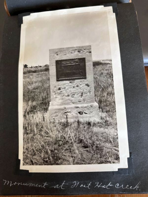
circa 1920’s
5. Along the Cheyenne to Deadwood Stage: Hat Creek Stage Station Marker
These photos are of a leather-bound album of South Dakota and Sylvan Lake.
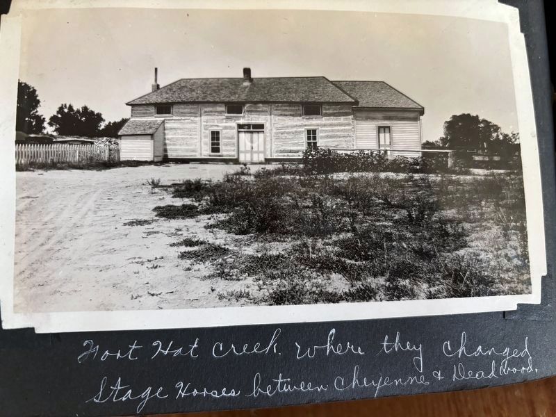
Photographed by C. Bob Unger, circa 1920’s
6. Along the Cheyenne to Deadwood Stage: Hat Creek Stage Station Marker
This is from a relatives album.
Credits. This page was last revised on July 26, 2025. It was originally submitted on September 28, 2016, by Barry Swackhamer of Brentwood, California. This page has been viewed 3,456 times since then and 180 times this year. Photos: 1, 2, 3, 4. submitted on September 28, 2016, by Barry Swackhamer of Brentwood, California. 5, 6. submitted on May 27, 2024, by C. Bob Unger of Raymore, Missouri.
