Short North Arts District in Columbus in Franklin County, Ohio — The American Midwest (Great Lakes)
Tod Barracks, 1863
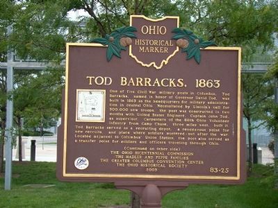
One of five Civil War military posts in Columbus, Tod Barracks, named in honor of Governor David Tod, was built in 1863 as the headquarters for military administration in central Ohio. Necessitated by Lincoln’s call for 300,000 new troops, the post was constructed in two months with United States Engineer, Captain John Tod, as supervisor. Carpenters of the 88th Ohio Volunteer Infantry from Camp Chase, three miles west, built it. Tod Barracks served as a recruiting depot, a rendezvous point for new recruits, and place where soldiers mustered-out after the war. Located adjacent to Columbus’ Union Station, the post also served as a transfer point for soldiers and officers traveling through Ohio.
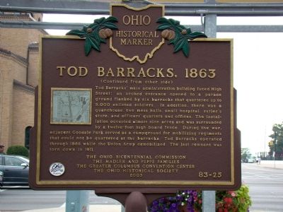
Tod Barracks’ main administration building faced High Street; an arched entrance opened to a parade ground flanked by six barracks that quartered up to 5,000 enlisted soldiers. In addition, there was a guardhouse, two mess halls, small hospital, sutler’s store, and officers’ quarters and offices. The installation occupied almost nine acres and was surrounded by a twelve-foot high board fence. During the war, adjacent Goodale Park served as a campground for mobilizing regiments that could not be quartered at the barracks. Tod Barracks operated through 1866 while the Union army demobilized. The last remnant was torn down in 1911.
Erected 2003 by The Ohio Bicentennial Commission, the Hadler and Peppe Families, the Greater Columbus Convention Center, and The Ohio Historical Society. (Marker Number 83-25.)
Topics and series. This historical marker is listed in this topic list: War, US Civil. In addition, it is included in the Ohio Historical Society / The Ohio History Connection series list. A significant historical year for this entry is 1863.
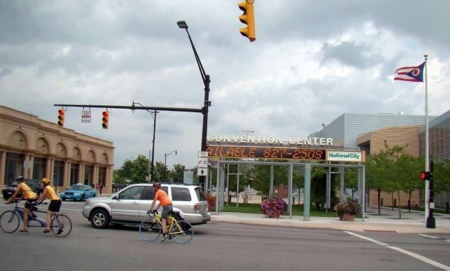
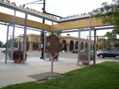
Location. 39° 58.423′ N, 83° 0.156′ W. Marker is in Columbus, Ohio, in Franklin County. It is in the Short North Arts District. Marker is at the intersection of North High Street and Goodale Street, on the right when traveling north on North High Street. Marker is in a small park at the edge of the convention center, across from the Union Station shops. It is difficult to see from High Street when heading north. Touch for map. Marker is in this post office area: Columbus OH 43215, United States of America. Touch for directions.
Other nearby markers. At least 8 other markers are within walking distance of this marker. Arnold Schwarzenegger (about 600 feet away, measured in a direct line); Lincoln Goodale (approx. 0.2 miles away); James S. Tyler / Tyler Family Legacy (approx. 0.2 miles away); Reverend Father Alexander Cestelli / Chiesta Italiana di San Giovanni Battista (approx. 0.3 miles away); Father Rocco Petrarca (approx. 0.3 miles away); Flytown (approx. 0.3 miles away); Columbus' First Professional Game (approx. half a mile away); The Columbus Buckeyes (approx. half a mile away). Touch for a list and map of all markers in Columbus.
Regarding Tod Barracks, 1863. The Convention Center now sits on land that was once Tod Barracks and the original Union Station and parts of its rail yard. Compare the street grid in the map reproduced in Photo No. 4 with the marker's current map.
Credits. This page was last revised on February 3, 2023. It was originally submitted on August 2, 2008, by J. J. Prats of Powell, Ohio. This page has been viewed 1,224 times since then and 24 times this year. Photos: 1, 2, 3, 4. submitted on August 2, 2008, by J. J. Prats of Powell, Ohio. • Craig Swain was the editor who published this page.


