Middletown in Middlesex County, Connecticut — The American Northeast (New England)
Middletown in the 1600s
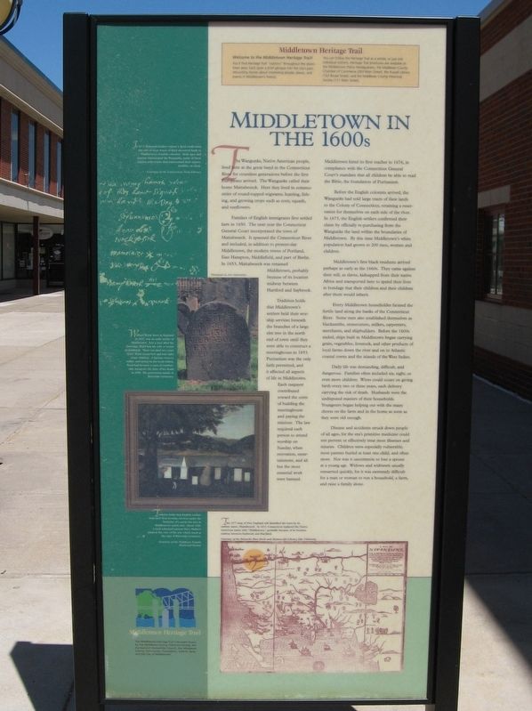
The Wangunks, Native American people, lived here at the great bend in the Connecticut River for countless generations before the first Europeans arrived. The Wangunks called their home Mattabeseck. Here they lived in communities of round-topped wigwams, hunting, fishing, and growing crops such as corn, squash, and sunflowers.
Families of English immigrants first settled here in 1650. The next year the Connecticut General Court incorporated the town of Mattabeseck. It spanned the Connecticut River and included, in addition to present-day Middletown, the modern town of Portland, East Hampton, Middlefield, and part of Berlin. In 1653, Mattabeseck was renamed Middletown, probably because of its location midway between Hartford and Saybrook.
Tradition holds that Middletown’s settlers held their worship services beneath the branches of a large elm tree in the north end of town until they were able to construct a meetinghouse in 1653. Puritanism was the only faith permitted, and it affected all aspects of life in Middletown. Each taxpayer contributed toward the costs of building the meetinghouse and paying the minister. The law required each person to attend worship on Sunday, when recreation, entertainment, and all but the most essential work were banned.
Middletown hired its first teacher in 1676, in compliance with the Connecticut General Court's mandate that all children be able to read the Bible, the foundation of Puritanism.
Before the English colonists arrived, the Wangunks had sold large tracts of their lands to the Colony of Connecticut, retaining a reservation for themselves on each side of the river In 1673, the English settlers confirmed their claim by officially re-purchasing from the Wangunks the land within the boundaries of Middletown. By this time Middletown's white population had grown to 200 men, women and children.
Middletown's first black residents arrived perhaps as early as the 1660s. They came against their will, as slaves, kidnapped from their native Africa and transported here to spend their lives in bondage that their children and their children after them would inherit.
Every Middletown householder farmed the fertile land along the banks of the Connecticut River. Some men also established themselves as blacksmiths, stonecutters, millers, carpenters merchants, and shipbuilders. Before the 1600s ended, ships built in Middletown began carrying grain, vegetables, livestock, and other products of local farms down the river and on to Atlantic coastal towns and the islands of the West Indies.
Daily life was demanding, difficult, and dangerous Families often included six, eight, or even more children. Wives could count on giving birth every two or three years, each delivery carrying the risk of death. Husbands were the undisputed masters of their households. Youngsters began helping out with the many chores on the farm and in the home as soon as they were old enough.
Disease and accidents struck down people of all ages, for the era's primitive medicine could not prevent or effectively treat most illnesses and injuries. Children were especially vulnerable; most parents buried at least one child, and often more. Nor was it uncommon to lose a spouse at a young age. Widows and widowers usually remarried quickly, for it was extremely difficult for a man or woman to run a household, a farm and raise a family alone.
In 1673, Wangunk leaders signed a deed confirming the sale of large tracts of their ancestral lands to Middletown’s English colonists. Both men and women represented the Wangunks, many of them signing with marks that represented their names, families, or clans.
- Courtesy of the Connecticut State Library
William Ward, born in England in 1632, was an early settler of Middletown. Just a year after his marriage, Ward lost his wife, a victim of childbirth. Their son died two years later. Ward remarried and had eight more children. A farmer, weaver, miller, and ensign in the local militia, Ward had become a man of comfortable means by the time of his death in 1690. His gravestone stands in Riverside Cemetery.
Tradition holds that Middletown’s settlers held their worship services under the branches of a great elm tree in Middletown’s north end. About 1840, a local schoolgirl named Mary Hulbert painted this view of the tree which stood at the edge of Riverside Cemetery.
This 1677 map of New England still identified the town by its earliest name, Mattabeseck. In 1653, Connecticut replaced the native American name with “Middletown,” probably because of its location midway between Saybrook and Hartford.
- Courtesy of the beinecke Rare Book and Manuscript Library, Yale University.
Erected by the Middlesex County Historical Society.
Topics. This historical marker is listed in these topic lists: Colonial Era • Settlements & Settlers.
Location. 41° 33.609′ N, 72° 38.945′ W. Marker is in Middletown, Connecticut, in Middlesex County. Marker is at the intersection of Main Street and Court Street, on the right when traveling north on Main Street. Touch for map. Marker is at or near this postal address: 100 Main Street, Middletown CT 06457, United States of America. Touch for directions.
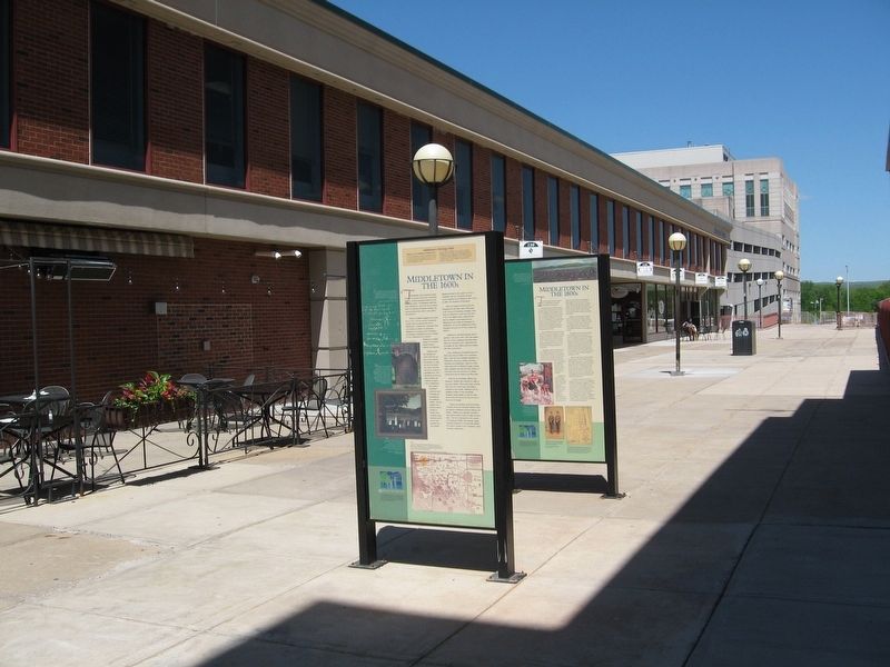
Other nearby markers. At least 8 other markers are within walking distance of this marker. Middletown in the 1700s (here, next to this marker); Middletown in the 1800s (here, next to this marker); Middletown in the 1900s (here, next to this marker); Bigelow Tavern (here, next to this marker); Middletown and the Connecticut River (about 600 feet away, measured in a direct line); Old City Hall Bell (about 700 feet away); Russell Library (approx. 0.2 miles away); The UNESCO Slave Route Project (approx. 0.2 miles away). Touch for a list and map of all markers in Middletown.
More about this marker. Weather has affected the clarity of the text and pictures. The Middlesex County Historical Society generously aided in transcribing this marker.
Credits. This page was last revised on November 13, 2020. It was originally submitted on October 10, 2016, by Michael Herrick of Southbury, Connecticut. This page has been viewed 432 times since then and 28 times this year. Photos: 1, 2. submitted on October 10, 2016, by Michael Herrick of Southbury, Connecticut.

