Macon in Bibb County, Georgia — The American South (South Atlantic)
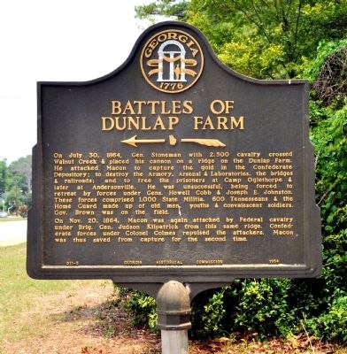
Battles of Dunlap Farm
←
Inscription.
On July 30, 1864, Gen. Stoneman with 2,500 cavalry crossed Walnut Creek & placed his cannon on a ridge on the Dunlap farm. He attacked Macon to capture the gold in the Confederate Depository; to destroy the Armory, Arsenal & Laboratories, the bridges & railroads; and to free the prisoners at Camp Oglethorpe & later at Andersonville. He was unsuccessful, being forced to retreat by forces under Gens. Howell Cobb and Joseph E. Johnston. These forces comprised 1,000 State Militia, 600 Tennesseans, & the Home Guard made up of old men, youths & convalescent soldiers. Gov. Brown was on the field.
On Nov. 20, 1864 Macon was again attacked by Federal cavalry under Brig. Gen. Judson Kilpatrick from this same ridge. Confederate forces under Colonel Colmes repulsed the attackers. Macon was thus saved from capture for the second time.
Erected 1954 by Georgia Historical Commission. (Marker Number 011-5.)
Topics and series. This historical marker is listed in this topic list: War, US Civil. In addition, it is included in the Georgia Historical Society, and the Sherman’s March to the Sea series lists. A significant historical month for this entry is July 1972.
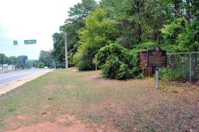
Location. 32° 50.575′ N, 83° 36.205′ W. Marker is in Macon, Georgia, in Bibb County. Marker is on Ocmulgee National Park Road, 0.2 miles Emery Highway (Georgia Route 80), on the right when traveling south. Marker located on the grounds of Ocmulgee National Monument Park. Park address is 1207 Emery Hwy, Macon, GA 31217. Touch for map. Marker is in this post office area: Macon GA 31217, United States of America. Touch for directions.
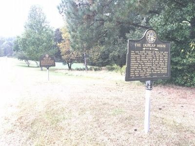
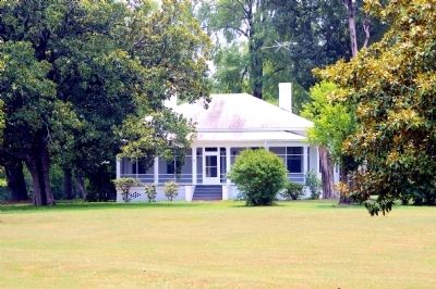
Other nearby markers. At least 8 other markers are within walking distance of this marker. The Dunlap House (a few steps from this marker); Ocmulgee National Monument (within shouting distance of this marker); Yaupon Holly (about 300 feet away, measured in a direct line); William Bartram Trail (about 300 feet away); The Civilian Conservation Corps (CCC) 1933-1942 (about 300 feet away); 17,000 Years of Continuous Human Habitation (about 300 feet away); a different marker also named The Dunlap House (about 700 feet away); The Battle of Dunlap Hill-Stoneman's Raid (about 700 feet away). Touch for a list and map of all markers in Macon.
More about this marker. Marker was previously located outside of fence line of the park. In 2013 in conjunction with two National Parks Services markers placed on park grounds, this marker was moved to its present location inside the park.
Credits. This page was last revised on April 6, 2024. It was originally submitted on July 13, 2011, by David Seibert of Sandy Springs, Georgia. This page has been viewed 1,709 times since then and 44 times this year. Last updated on October 12, 2016, by Brandon D Cross of Flagler Beach, Florida. Photos: 1. submitted on July 13, 2011, by David Seibert of Sandy Springs, Georgia. 2. submitted on November 12, 2016, by Brandon D Cross of Flagler Beach, Florida. 3. submitted on October 12, 2016, by Brandon D Cross of Flagler Beach, Florida. 4, 5. submitted on July 13, 2011, by David Seibert of Sandy Springs, Georgia. • Bernard Fisher was the editor who published this page.


