Cape Charles in Northampton County, Virginia — The American South (Mid-Atlantic)
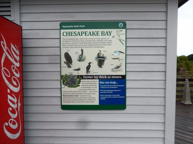
Chesapeake Bay
Kiptopeke State Park
The Chesapeake Bay, vital to the survival of many species of shorebirds and birds of prey, provides fish, mollusks, and crabs as well as a variety of nesting habitats along the Eastern Shore. Many of these birds can be seen gliding along the hulls of the concrete ships searching for food and a resting place.
Oyster lay thick as stones
Poor water quality in the Chesapeake Bay, caused by pollutants in stormwater run-off is causing problems for many species, particularly oysters. John Smith, during his 1608 exploration of the Bay wrote, “Oyster lay thick as stones.” Oyster farming, protected areas, and conservation education are part of a multi-faceted plan to restore the Chesapeake Bay to its pristine natural state.
You can help…
• Use native plants for landscaping and avoid over use of fertilizers
• Pick up and properly dispose of pet waste and litter
• Allow stormwater to percolate, use paving stones or gravel instead of asphalt
Topics. This historical marker is listed in these topic lists: Animals • Environment • Industry & Commerce • Waterways & Vessels. A significant historical year for this entry is 1608.
Location. 37° 10.056′ N, 75° 59.206′ W. Marker is in Cape Charles, Virginia, in Northampton County. Marker is on Kiptopeke Drive (County Route 704) 0.4 miles west of Florida Avenue, on the right when traveling west. Touch for map. Marker is at or near this postal address: 3540 Kiptopeke Drive, Cape Charles VA 23310, United States of America. Touch for directions.
Other nearby markers. At least 8 other markers are within 5 miles of this marker, measured as the crow flies. The Dunes (here, next to this marker); Farm to Market (here, next to this marker); Maritime Highway (here, next to this marker); A Good Start (about 700 feet away, measured in a direct line); Concrete Ships (about 700 feet away); Chesapeake Bay Bridge-Tunnel (approx. 2.7 miles away); Fisherman Island NWR (approx. 3.4 miles away); Mansion Site (approx. 4.3 miles away). Touch for a list and map of all markers in Cape Charles.

Photographed By Don Morfe, September 21, 2016
3. The entrance to Kiptopeke State Park
Virginia Department of Conservation and Recreation entry
Click for more information.
Click for more information.
Credits. This page was last revised on May 21, 2021. It was originally submitted on October 12, 2016, by Don Morfe of Baltimore, Maryland. This page has been viewed 330 times since then and 8 times this year. Photos: 1, 2, 3. submitted on October 12, 2016, by Don Morfe of Baltimore, Maryland. • Bernard Fisher was the editor who published this page.

