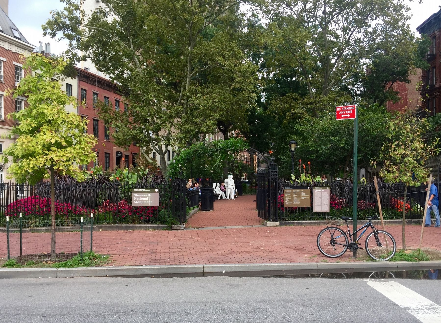
West Village in Manhattan in New York County, New York — The American Northeast (Mid-Atlantic)
Christopher Park
.145 Acre
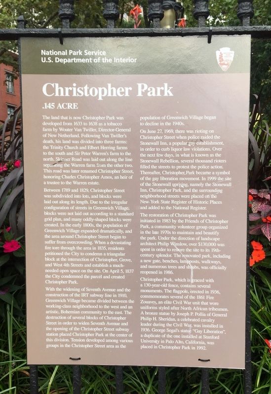
The land that is now Christopher Park was developed from 1633 to 1638 as a tobacco farm by Wouter Van Twiller, Director-General of New Netherland. Following Van Twiller’s death, his land was divided into three farms: the Trinity Church and Elbert Herring farms to the south and Sir Peter Warren’s farm to the north. Skinner Road was laid out along the line separating the Warren farm from the other two. This road was later renamed Christopher Street, honoring Charles Christopher Amos, an heir of a trustee to the Warren estate
Between 1789 and 1829, Christopher Street was subdivided into lots, and blocks were laid out along its length. Due to the irregular configuration of streets in Greenwich Village, blocks were not laid out according to a standard grid plan, and many oddly-shaped blocks were created. In the early 1800s, the population of Greenwich Village expanded dramatically, and the area around Christopher Street began to suffer from overcrowding. When a devastating fire tore through the area in 1835, residents petitioned the City to condemn a triangular block at the intersection of Christopher, Grove, and West 4th Streets and establish a much-needed open space on the site. On April 5, 1837 the City condemned the parcel and created Christopher Park.
With the widening of Seventh Avenue and the construction of the IRT subway line in 1910, Greenwich Village became divided between the working-class neighborhood to the west and an artistic, Bohemian community to the east. The destruction of several blocks of Christopher Street in order to widen Seventh Avenue and the opening of the Christopher Street subway station placed Christopher Park at the center of this division. Tension developed among various groups in the Christopher Street area as the population of Greenwich Village began to decline in the 1940s.
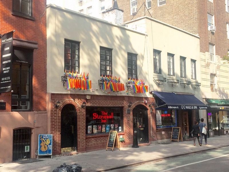
On June 27, 1969, there was rioting on Christopher Street when police raided the Stonewall Inn, a popular gay establishment, in order to curb liquor law violations. Over the next few days, in what is known as the Stonewall Rebellion, several thousand rioters filled the streets to protest the police action. Thereafter, Christopher Park became a symbol of the gay liberation movement. In 1999 the site of the Stonewall uprising—the Stonewall Inn, Christopher Park, and the surrounding neighborhood streets—were placed on the New York State Register of Historic Places and added to the National Register.
The restoration of Christopher Park was initiated in 1983 by the Friends of Christopher Park, a community volunteer group organized in the late 1970s to maintain and beautify the park. Under the direction of landscape architect Philip Winslow, over $130,000 was spent
in order to restore the site to its 19th-century splendor. The renovated park, including a new gate, benches, lampposts, walkways, and numerous trees and shrubs, was officially reopened in 1986.
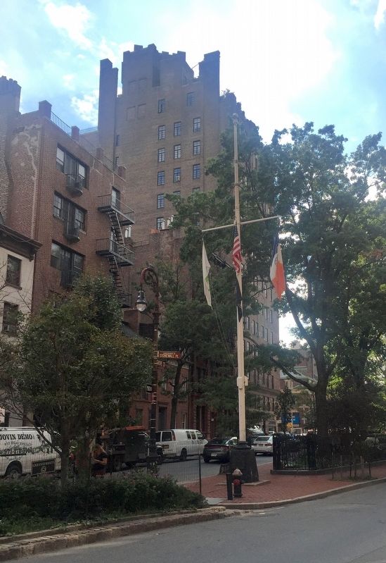
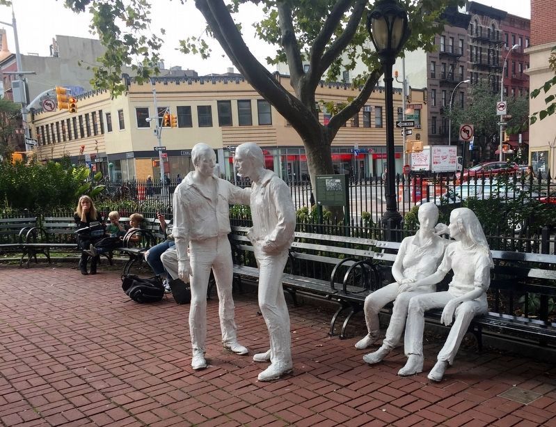
Christopher Park, which is graced with a 130-year-old fence, contains several monuments. The flagpole, erected in 1936, commemorates several of the 1861 Fire Zouaves, an elite Civil War unit that wore uniforms styled after North African tribesmen. A bronze statue by Joseph P. Pollia of General Philip H. Sheridan, a celebrated cavalry leader during the Civil War, was installed in 1936. George Segal’s statue Gay Liberation, a duplicate of the one installed at Stanford University in Palo Alto, California, was placed in Christopher Park in 1992.
Erected by National Park Service, U.S. Department of the Interior.
Topics. This historical marker is listed in these topic lists: Arts, Letters, Music • Civil Rights • Law Enforcement • Settlements & Settlers. A significant historical date for this entry is April 5, 1837.
Location. Marker has been reported missing. It was located near 40° 44.012′ N, 74° 0.155′ W. Marker was in Manhattan, New York, in New York County. It was in West Village. Marker was at the intersection of West 4th Street and Grove
Street, on the left when traveling north on West 4th Street. Christopher Park is now part of Stonewall National Monument. Touch for map. Marker was at or near this postal address: 53 Christopher Street, New York NY 10014, United States of America. Touch for directions.
Other nearby markers. At least 8 other markers are within walking distance of this location. Stonewall Forever (a few steps from this marker); Gay Liberation Monument (a few steps from this marker); a different marker also named Stonewall Forever (within shouting distance of this marker); a different marker also named Stonewall Forever (within shouting distance of this marker); a different marker also named Stonewall Forever (within shouting distance of this marker); General Philip Henry Sheridan (within shouting distance of this marker); The Hess Triangle (within shouting distance of this marker); The Sheridan Square Garden (within shouting distance of this marker). Touch for a list and map of all markers in Manhattan.
More about this marker. The marker is attached to the fence to the right of the entrance to the park on West 4th Street.
Related marker. Click here for another marker that is related to this marker. This marker replaced the linked marker, which had a different erecting organization (NYC Parks) cited.
Also see . . .
1. Making Christopher Park a National Park (Greenwich Village Society for Historical Preservation). (Submitted on October 15, 2016.)
2. Announcing the Stonewall National Monument (Youtube.com, The White House, 4 mins.)
. "I’m designating the Stonewall National Monument as the newest addition to America’s national parks system. Stonewall will be our first national monument to tell the story of the struggle for LGBT rights. I believe our national parks should reflect the full story of our country – the richness and diversity and uniquely American spirit that has always defined us. That we are stronger together. That out of many, we are one." - President Barack Obama (Submitted on October 15, 2016.)
3. Civil Rights at Stonewall National Historic Landmark (National Park Service). (Submitted on October 15, 2016.)
Additional keywords. LGBT LGBTQ
Credits. This page was last revised on June 19, 2023. It was originally submitted on October 15, 2016, by Andrew Ruppenstein of Lamorinda, California. This page has been viewed 540 times since then and 31 times this year. Photos: 1, 2, 3, 4, 5, 6. submitted on October 15, 2016, by Andrew Ruppenstein of Lamorinda, California.
