Lucketts in Loudoun County, Virginia — The American South (Mid-Atlantic)
Catoctin Rural Historic District
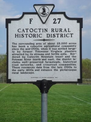
Photographed by J. J. Prats, April 30, 2007
1. Catoctin Rural Historic District Marker
Erected 1991 by the Department of Historic Resources. (Marker Number F-27.)
Topics and series. This historical marker is listed in these topic lists: Agriculture • Settlements & Settlers. In addition, it is included in the Virginia Department of Historic Resources (DHR) series list.
Location. 39° 12.741′ N, 77° 32.125′ W. Marker is in Lucketts, Virginia, in Loudoun County. It is on James Monroe Highway (U.S. 15) south of Stumptown Road and Lucketts Road, on the left when traveling south. It is next to the Elementary School at Lucketts Community Park. Touch for map. Marker
this page online

Regionally, this marker is in the Washington Metropolitan Area and in Northern Virginia. It is also in the American South, specifically in the Upper South, and in the Mid-Atlantic. Globally, it is in North America, the Western Hemisphere, the Western World, and the Anglosphere. Historically, it finds itself in what was once the territory of the Mississippian Culture, one of the original Thirteen Colonies, one of the Confederate States of America, and the Antebellum South.
Other nearby markers. At least 8 other markers are within 3 miles of this marker, measured as the crow flies: A different marker also named Wayne's Crossing (a few steps from this marker); Lucketts School (approx. 0.2 miles away); Potomac Crossings (approx. half a mile away); The Kincaid Farm Barns (approx. 2.3 miles away); Welcome to Temple Hall Farm Regional Park (approx. 2.3 miles away); Conditions of the Enslaved at Temple Hall Farm (approx. 2.3 miles away); Enslaved Workers at Temple Hall Farm (approx. 2.3 miles away); This Is Temple Hall! (approx.

Photographed by Devry Becker Jones (CC0), January 10, 2026
2. Catoctin Rural Historic District Marker with the Wayne's Crossing Marker
Another marker is no longer nearby. Wayne's Crossing (was a few steps from this marker but has been replaced with another marker now near it).
More about this marker. This and the other marker are turned to face the roadway, so they are difficult to see until you are upon them.
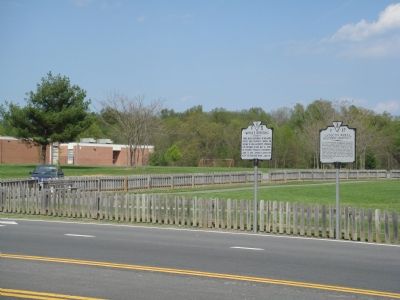
Photographed by J. J. Prats, April 30, 2007
3. F-5 (the replaced one) and F-27 Markers Side By Side
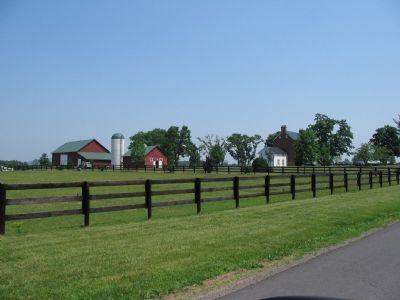
Photographed by Craig Swain, June 16, 2007
4. Red Hill Farm
Established in 1840, Red Hill Farm is one of many in the area.
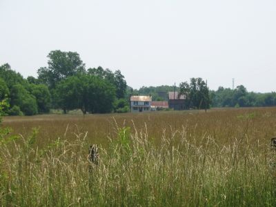
Photographed by Craig Swain, June 17, 2007
5. Farm on the Catoctin Mountains
Many barns, silos, and farm homesteads are tucked into the ridges and valleys of the Catoctin Mountains.
Credits. This page was last revised on January 11, 2026. It was originally submitted on May 2, 2007, by J. J. Prats of Powell, Ohio. This page has been viewed 1,765 times since then and 29 times this year. Photos: 1. submitted on May 2, 2007, by J. J. Prats of Powell, Ohio. 2. submitted on January 11, 2026, by Devry Becker Jones of Washington, District of Columbia. 3. submitted on May 2, 2007, by J. J. Prats of Powell, Ohio. 4, 5. submitted on June 17, 2007, by Craig Swain of Leesburg, Virginia.
