Harbour Mouth Defences / Défense de l'entrée du port
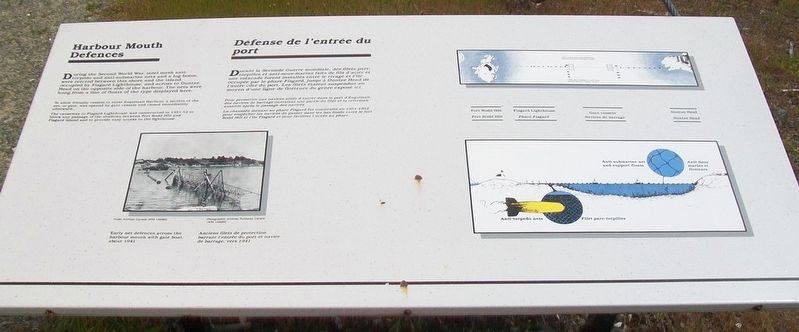
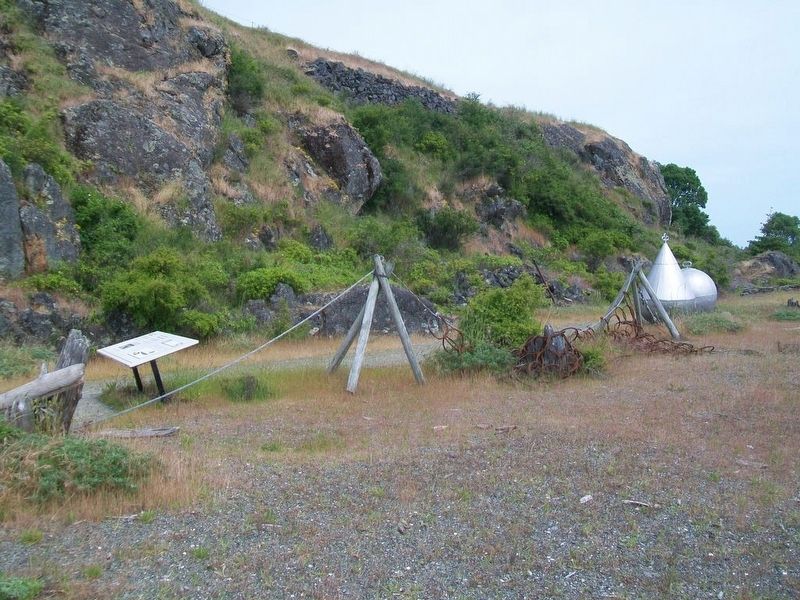
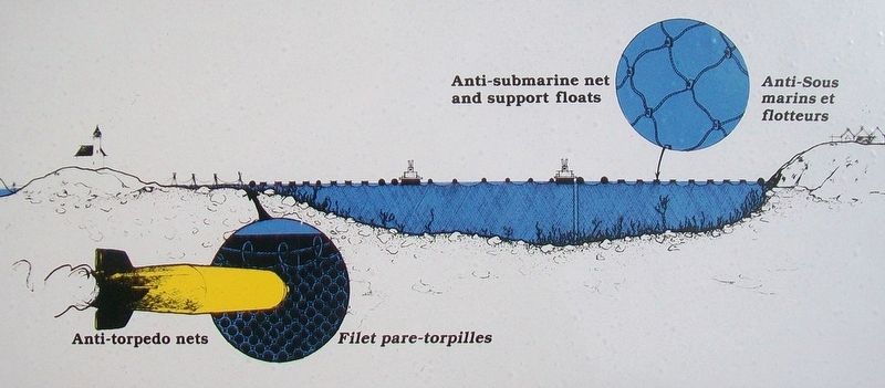
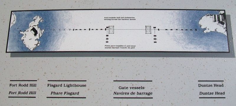
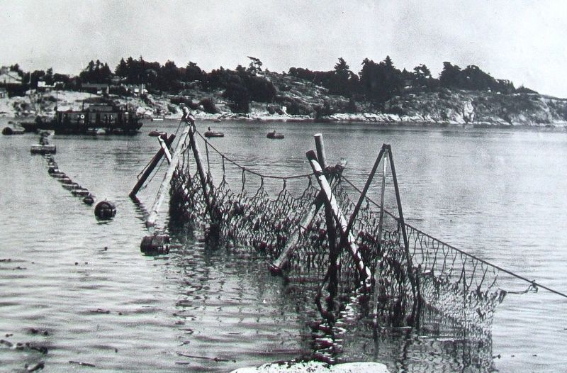
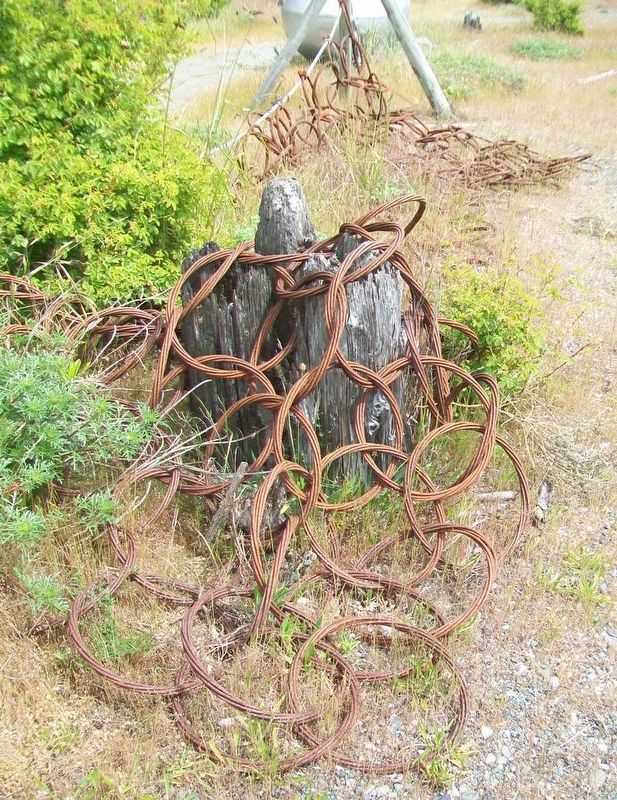
During the Second World War, steel mesh anti-torpedo and anti-submarine nets and a log-boom, were erected between this shore and the island occupied by Fisgard Lighthouse, and across to Duntze Head on the opposite side of the harbour. The nets were hung from a line of floats of the type displayed here.
To allow friendly vessels to enter Esquimalt Harbour, a section of the net, or gate, was opened by gate vessels and closed immediately afterward.
The causeway to Fisgard Lighthouse was constructed in 1951-52 to block any passage of the shallows between Fort Rodd Hill and Fisgard Island and to provide easy access to the lighthouse.
—————————————
Durant la Seconde Guerre mondiale, des filets pare-torpilles et anti-sous-marins faits de fils d'acier et une estacade furent installés entre le rivage et l'île occupée par le phare Fisgard, jusqu'à Duntze Head de l'autre côté du port. Les filets étaient suspendus au moyen d'une ligne de flotteurs du genre exposé ici.
Pour permettre aux navires alliés d'entrer dans le port d'Esquimalt, des navires de barrage ouvraient une partie du filet et la refermait aussitôt après le passage des navires.
La chaussée menant au phare Fisgard fut construite en 1951-1952 pour empêcher les navires
de passer dans les bas-fonds entre le fort Rodd Hill et l'île Fisgard et pour faciliter l'accès au phare.
[Photo caption reads]
Early net defences across the harbour mouth with gate boat, about 1941.
Anciens filets de protection barrant l'entrée du port et navire de barrage, vers 1941
Erected by Parks Canada.
Topics and series. This historical marker is listed in these topic lists: Forts and Castles • War, World II • Waterways & Vessels. In addition, it is included in the Lighthouses series list. A significant historical year for this entry is 1941.
Location. 48° 25.88′ N, 123° 27.035′ W. Marker is in Victoria, British Columbia, in Capital. Marker is on the grounds of Fort Rodd Hill and Fisgard Lighthouse National Historic Sites of Canada. Touch for map. Marker is at or near this postal address: 603 Fort Rodd Hill Road, Victoria BC V9C 2W8, Canada. Touch for directions.
Other nearby markers. At least 8 other markers are within walking distance of this marker. Searchlight Emplacement / Emplacement de projecteur (within shouting distance of this marker); Team Work / Travail d'equipe (within shouting distance of this marker); Canteen / Cantine (about 90 meters away, measured in a direct line); Underground Magazine / Magasin souterrain (about 90 meters away); Lower Battery / Batterie inférieure (about 90
Also see . . .
1. Fort Rodd Hill and Fisgard Lighthouse National Historic Sites of Canada. Parks Canada website entry (Submitted on October 21, 2016, by William Fischer, Jr. of Scranton, Pennsylvania.)
2. Defending the Coast. CFB Esquimalt website entry (Submitted on October 21, 2016, by William Fischer, Jr. of Scranton, Pennsylvania.)
Credits. This page was last revised on December 18, 2021. It was originally submitted on October 21, 2016, by William Fischer, Jr. of Scranton, Pennsylvania. This page has been viewed 328 times since then and 10 times this year. Photos: 1, 2, 3, 4, 5, 6. submitted on October 21, 2016, by William Fischer, Jr. of Scranton, Pennsylvania.
