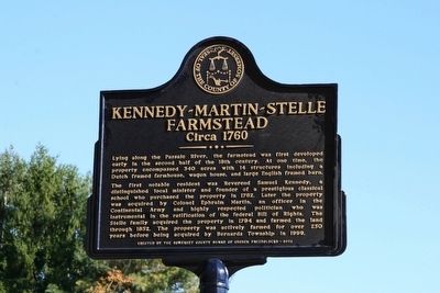
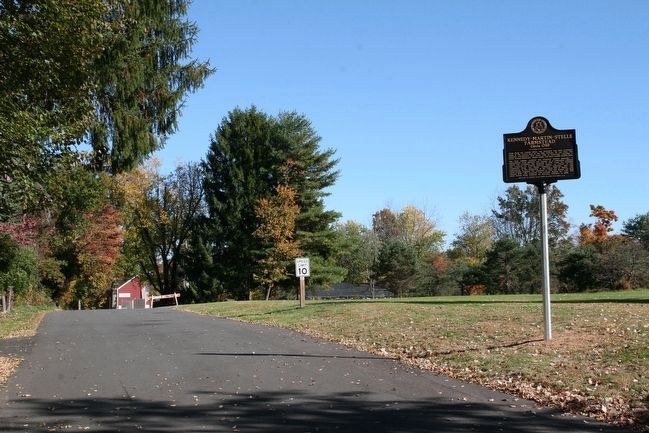
Kennedy-Martin-Stelle Farmstead
Circa 1760
The first notable resident was Reverend Samuel Kennedy, a distinguished local minister and founder of a prestigious classical school who purchased the property in 1762. Later the property was acquired by Colonel Ephraim Martin, an officer in the Continental Army and highly respected politician who was instrumental in the ratification of the federal Bill of Rights. The Stelle family acquired the property in 1794 and farmed the land through 1852. The property was actively farmed for over 250 years before being acquired by Bernards Township in 1999.
Erected 2015 by Somerset County Board of Chosen Freeholders.
Topics. This historical marker is listed in these topic lists: Agriculture • Churches & Religion • Colonial Era • War, US Revolutionary. A significant historical year for this entry is 1760.
Location. 40° 39.492′ N, 74° 31.818′ W. Marker is in Basking Ridge, New Jersey, in Somerset County. Marker can be reached from King George Road (County Route 651). The marker is approximately
Other nearby markers. At least 8 other markers are within 2 miles of this marker, measured as the crow flies. A different marker also named Kennedy-Martin-Stelle Farmstead (about 600 feet away, measured in a direct line); a different marker also named Kennedy-Martin-Stelle Farmstead (about 600 feet away); Morris County (approx. half a mile away); Millington Railroad Station (approx. 1.1 miles away); Frederick W. Schmidt (approx. 1.2 miles away); Millington Schoolhouse #74 (approx. 1.4 miles away); Vail Family (approx. 1.4 miles away); Mt. Bethel Meeting House (approx. 1.6 miles away). Touch for a list and map of all markers in Basking Ridge.
More about this marker. The Kennedy-Martin-Stelle Farmstead is a vestige of Bernard’s Township’s rural agricultural past. Dating back to the mid 18th century, the one-and-one half story farmhouse, with its Dutch framing system, typifies the regions early domestic architecture. The farmhouse contains evidence of its Colonial past, as well as Georgian, Federal, Victorian and Colonial Revival features. The four-bay 18th century barn, with a c.1840 addition, is a notable example of the English barn type. It exhibits hand-hewn rafters with pegged wind braces and a lower level stable at on end. The wagon house (c.1750-1820) exhibits both Dutch and English framing techniques.
Regarding Kennedy-Martin-Stelle Farmstead. The Kennedy-Martin-Stelle Farmstead is owned by Bernards Township and is operated by the Friends of the Kennedy-Martin-Stelle Farmstead. Located at the site is Farmstead Arts which is a community of artists and visionaries who are dedicated to creating a home for fine, performing and practical arts (www.farmsteadartscenter.org).
Credits. This page was last revised on October 31, 2016. It was originally submitted on October 23, 2015, by Thomas R. D'Amico of Somerville, New Jersey. This page has been viewed 515 times since then and 22 times this year. Last updated on October 25, 2016, by Thomas R. D'Amico of Somerville, New Jersey. Photos: 1, 2, 3. submitted on October 23, 2015, by Thomas R. D'Amico of Somerville, New Jersey. • Bill Pfingsten was the editor who published this page.


