Ironton in Iron County, Missouri — The American Midwest (Upper Plains)
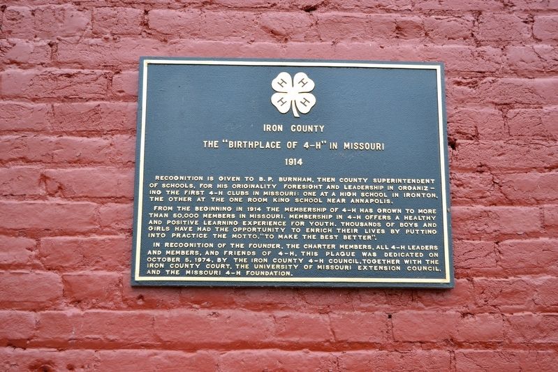
Iron County - The "Birthplace of 4-H" in Missouri
1914
Inscription.
Recognition is given to B.P. Burnham, then county superintendent of schools, for his originality foresight and leadership in organizing the first 4-H clubs in Missouri: one at a high school in Ironton, the other at the one room King School near Annapolis.
From the beginning in 1914 the membership of 4-H has grown to more than 50,000 members in Missouri. Membership in 4-H offers a healthy and positive learning experience for youth. Thousands of boys and girls have had the opportunity to enrich their lives by putting into practice the motto, “To Make the Best Better”.
In recognition of the founder, the charter members, all 4-H leaders and members, and friends of 4-H, this plaque was dedicated on October 5, 1974, by the Iron County 4-H Council, together with the Iron County Court, the University of Missouri Extension Council, and the Missouri 4-H Foundation.
Erected 1974 by Iron County 4-H Council.
Topics and series. This historical marker is listed in these topic lists: Agriculture • Education. In addition, it is included in the 4-H Youth Program series list. A significant historical year for this entry is 1914.
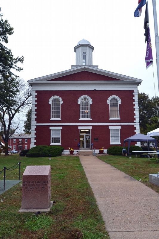
Location. 37° 35.873′ N, 90° 37.678′ W. Marker is in Ironton, Missouri, in Iron County. Marker can be reached from the intersection of S. Main Street and W. Russell Street. Marker is mounted at the front entrance of the Iron County Courthouse. Touch for map. Marker is in this post office area: Ironton MO 63650, United States of America. Touch for directions.
Other nearby markers. At least 8 other markers are within walking distance of this marker. VFW Post 5527 Veterans Memorial (a few steps from this marker); Iron County Courthouse (a few steps from this marker); Battle of Pilot Knob (a few steps from this marker); War In The Arcadia Valley (within shouting distance of this marker); Iron County Missouri Courthouse Complex (within shouting distance of this marker); General Grant Commission Commemorative (approx. 0.2 miles away); Fort Curtis (approx. half a mile away); The Arcadia Valley (approx. 0.8 miles away). Touch for a list and map of all markers in Ironton.
Credits. This page was last revised on October 27, 2016. It was originally submitted on October 27, 2016, by Duane Hall of Abilene, Texas. This page has been viewed 365 times since then and 19 times this year. Photos: 1. submitted on October 27, 2016, by Duane Hall of Abilene, Texas. 2. submitted on October 26, 2016, by Duane Hall of Abilene, Texas.

