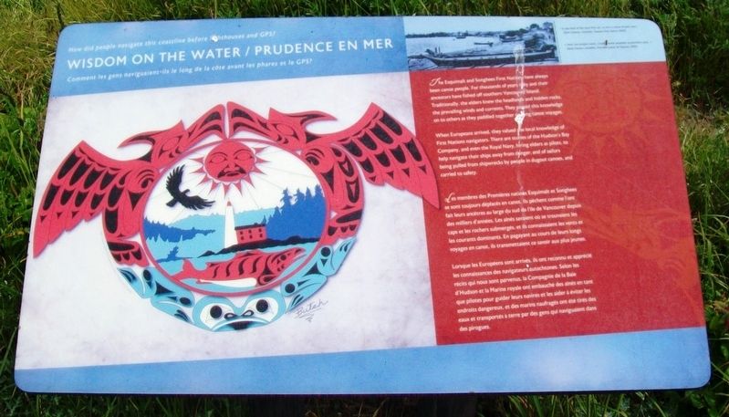
Wisdom on the Water / Prudence en Mer
How did people navigate this coastline before lighthouses and GPS?
Comment les gens naviguaient-ils le long de la côte avant les phares et le GPS?
—————————————
The Esquimalt and Songhees First Nations have always been canoe people. For thousands of years they and their ancestors have fished off southern Vancouver Island. Traditionally, the elders knew the headlands and hidden rocks, the prevailing winds and currents. They passed this knowledge on to others as they paddled together on long canoe voyages.
When Europeans arrived, they valued the local knowledge of First Nations navigators. There are stories of the Hudson's Bay Company, and even the Royal Navy, hiring elders as pilots, to help navigate their ships away from danger; and of sailors being pulled from shipwrecks by people in dugout canoes, and carried to safety.
Les membres des Premières nations Esquimalt et Songhees se sont toujours déplacés en canot. Ils pêchent comme l'ont fait leurs ancêtres au large du sud de l'ile de Vancouver depuis des milliers d'années. Les aînés savaient où se trouvaient les caps et les rochers submergés, et ils connaissaient les vents et les courants dominants. En pagayant au cours de leurs longs voyages en canot, ils transmettaient
ce savoir aux plus jeunes.Lorsque les Européens sont arrivés, ils ont reconnu et apprécié les connaissances des navigateurs autochtones. Selon les récits qui nous sont parvenus, la Compagnie de la Baie d'Hudson et la Marine royale ont embauché des aînés en tant que pilotes pour guider leurs navires et les aider à éviter les endroits dangereux, et des marins naufragés ont été tirés des eaux et transportés à terre par des gens qui naviguaient dans des piroques.
[Photo caption reads]
"It was kind of like your first car, to own a canoe of your own."
(Earle Claxton, councillor, Tsawout First Nation, 2000)
« Avoir son propre canot, c'était comme posséder sa première auto. »
(Earle Claxton, conseiller, Première nation de Tsawout, 2000)
Erected by Parks Canada.
Topics. This historical marker is listed in these topic lists: Exploration • Native Americans • Waterways & Vessels.
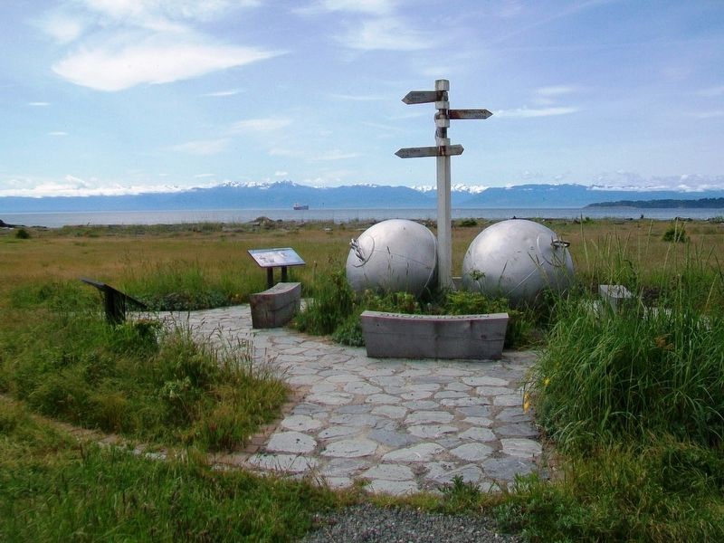
Location. 48° 25.91′ N, 123° 26.955′ W. Marker is in Victoria, British Columbia, in Capital. Marker is on the grounds of Fort Rodd Hill and Fisgard Lighthouse National Historic Sites of Canada. Touch for map. Marker is at or near this postal address: 603 Fort Rodd Hill Road, Victoria BC V9C 2W8, Canada. Touch for directions.
Other nearby markers. At least 8 other markers are within walking distance of this marker. Fisgard Lighthouse / Phare de Fisgard (here, next
Also see . . .
1. Fort Rodd Hill and Fisgard Lighthouse National Historic Sites of Canada. Parks Canada website entry (Submitted on October 28, 2016, by William Fischer, Jr. of Scranton, Pennsylvania.)
2. Songhees Nation. (Submitted on October 28, 2016, by William Fischer, Jr. of Scranton, Pennsylvania.)
Credits. This page was last revised on May 3, 2023. It was originally submitted on October 28, 2016, by William Fischer, Jr. of Scranton, Pennsylvania. This page has been viewed 269 times since then and 13 times this year. Photos: 1, 2. submitted on October 28, 2016, by William Fischer, Jr. of Scranton, Pennsylvania.

