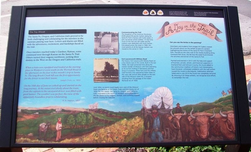
A Day on the Santa Fe Trail
1822 - 1872
The Trip Ahead
The Santa Fe, Oregon, and California trails proved to be both challenging and exhilarating for the travelers in the caravans passing near here. Letters and diaries are filled with the adventures, excitement, and hardships faced on the trail.
Once travelers reached today's Gardner, Kansas, some continued west through Kansas on the Santa Fe Trail. Others turned their wagons northwest, seeking their destiny in the West on the Oregon and California trails.
When a train was equipped and loaded at the starting place in Westport it went south on the Wornall Road in the afternoon on the four to five month's trip to Santa Fe. The long Brush Creek hill was the first opportunity for the driver to test their teams.
Joseph Chick, ca. 1850
On the 10th day of June we yoked up and started on the long journey. At the outset everybody about the train, from the captain to the cavayard driver, was filled with good humor. The weather was perfect, the view of the apparently boundless prairie exhilarating.
W. B. Napton, 1857
Commemorating the Trail
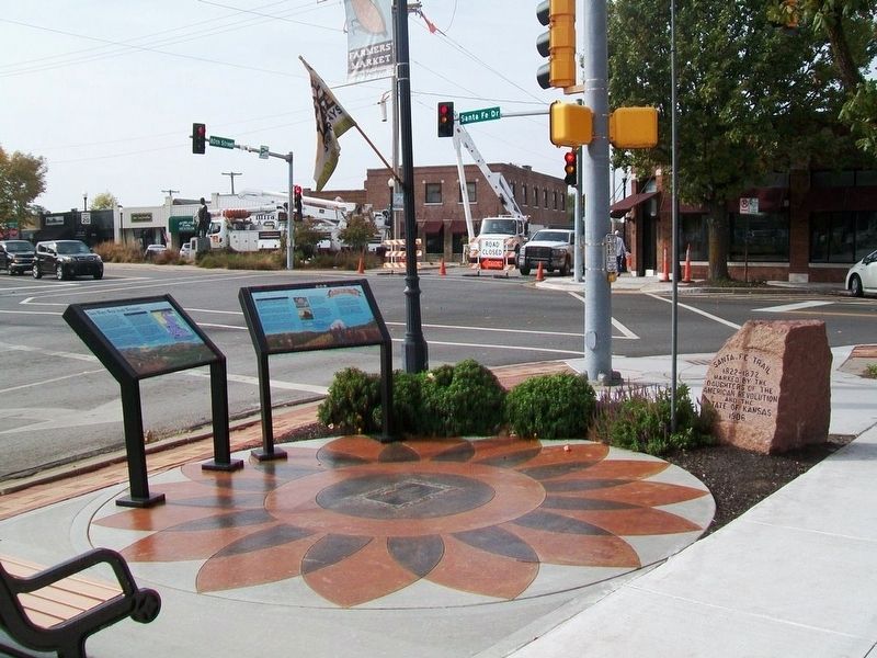
The Daughters of the American Revolution (DAR) placed 96 granite markers along the Santa Fe Trail in Kansas with funds raised, in part, by Kansas school children. At that time, much of the trail was still visible and the markers were
Fort Leavenworth Military Road
The historic Fort Leavenworth Military Road ran a few blocks east of this corner. Built in the late 1830s, the road connected forts along the western border of Missouri with forts extending as far as Fort Snelling in Minnesota and Fort Jesup in Louisiana. These forts and this military road formed a line separating Indian tribes on the west side and all other people on the east side of the Missouri state line, a situation resulting from the passage of the Indian Removal Act of 1830.
Until 1854, no towns could legally exist west of the Missouri State Line because of the Indian Trade and Intercourse Act of 1834. For this reason, the Santa Fe, Oregon, and California trails originated in the towns of Westport and Independence, the last places to buy wagons, animals, and outfitting supplies before crossing the state line.
Can you see the bricks in the painting?
Volunteers and students from Images Art Gallery created the artwork shown on this exhibit as part of a project highlighting the history of the Santa Fe Trail in Overland Park. Painted on the west wall of the nearby building along Overland Park Drive, the 94-foot life-sized mural showed the activities and terrain of
Painted and erected in 2013 with the help and support of business, private, artistic, and historical supporters in Overland Park and Johnson County, the mural added to the community's tradition of historic trail interpretation. Soon however, unforeseen problems with the wall surface caused the mural to disintegrate. Stabilization attempts failed and in July 2014 the mural was completely removed. By showing it on these exhibits, we recognize local efforts to remember the trail.
Erected by National Park Service, City of Overland Park, and the Kansas City Area Historic Trails Association.
Topics. This historical marker is listed in these topic lists: Industry & Commerce • Native Americans • Roads & Vehicles • Settlements & Settlers. A significant historical year for this entry is 1850.
Location. 38° 59.047′ N, 94° 40.309′ W. Marker is in Overland Park, Kansas, in Johnson County. Marker is at the intersection of 80th Street and Santa Fe Drive, on the right when traveling west on 80th Street. Touch for map. Marker is at or near this postal address: 7947 Santa Fe Drive, Overland Park KS 66204, United States of America. Touch for directions.
Other nearby markers. At least 8 other markers are within walking distance of this marker. "A Day on the Trail" (here, next to this marker); Two Ways West from Westport (here, next to this marker); Santa Fe Trail
Related marker. Click here for another marker that is related to this marker.
Also see . . .
1. Santa Fe National Historic Trail. National Park Service website entry (Submitted on November 2, 2016, by William Fischer, Jr. of Scranton, Pennsylvania.)
2. Oregon National Historic Trail. National Park Service website entry (Submitted on November 2, 2016, by William Fischer, Jr. of Scranton, Pennsylvania.)
3. California National Historic Trail. National Park Service website entry (Submitted on November 2, 2016, by William Fischer, Jr. of Scranton, Pennsylvania.)
4. Santa Fe Trail Markers. Daughters of the American Revolution website entry (Submitted on May 4, 2023, by Larry Gertner of New York, New York.)
Credits. This page was last revised on May 4, 2023. It was originally submitted on November 2, 2016, by William Fischer, Jr. of Scranton, Pennsylvania. This page has been viewed 486 times since then and 46 times this year. Photos: 1. submitted on November 2, 2016, by William Fischer, Jr. of Scranton, Pennsylvania. 2. submitted on November 1, 2016, by William Fischer, Jr. of Scranton, Pennsylvania.

